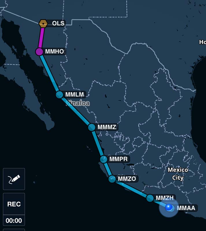
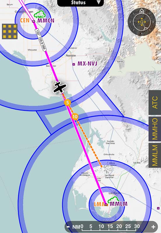
From January 29th to February 2nd, I flew from the US border down to Acapulco.
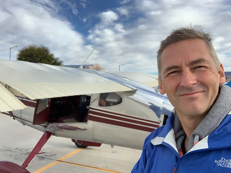
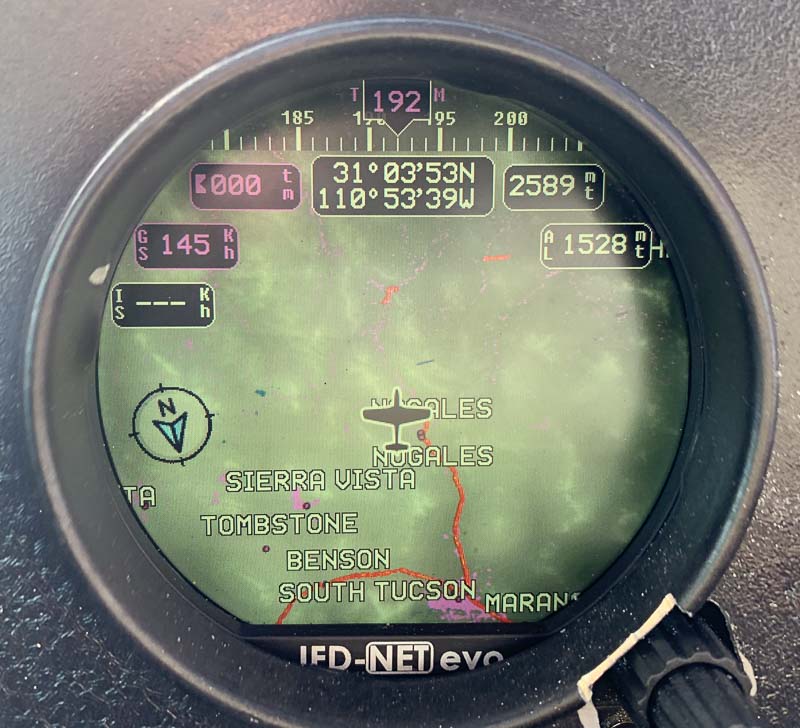
Today was the big day. Flying into Mexico. Leaving the well-know USA behind. I was prepared but felt, I could have done more. I read a lot of documents about border crossing, but a lot of it is outdated too. Fact is, most US pilots never leave the USA. And the US government makes it complicated. You need different permissions from different US departments using different IT systems requiring complicated passwords and procedures. I ordered a "decal" 3 weeks ago (and paid 30$ for it) but it didn't arrive in time. Now what was the procedure? Originally I wanted to leave via Yuma, but couldn't find Yuma in the updated list of AOE (Airports Of Entry). In Nogales, everybody was friendly, as usual. Customs arrived and said I can leave. I couldn't active my Cross-border flightplan with Foreflight, but Flight Service was there for me on the frequency and opened it for me. "Never cross the border without a squawk", says one of the border crossing documents, but Tucson Approach didn't give me one and I crossed the border with the VFR squawk 1200.
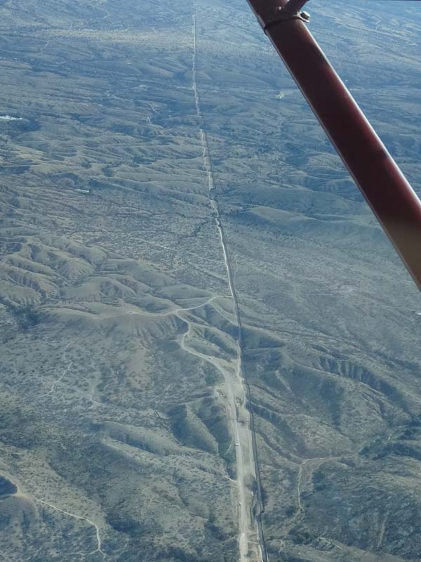
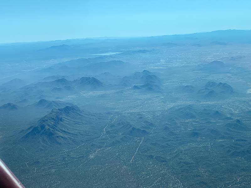
Guido asked me to make a picture of the border. Is it still a fence or already a wall?
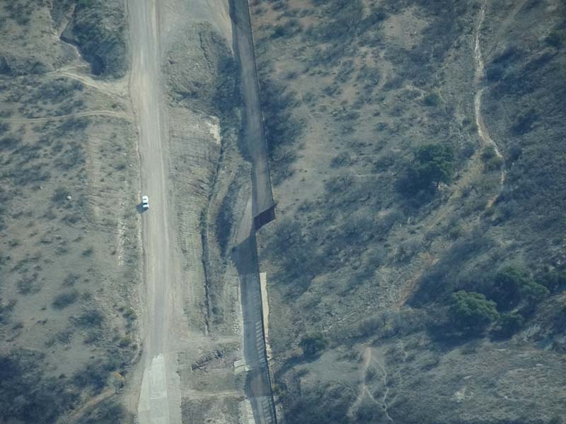
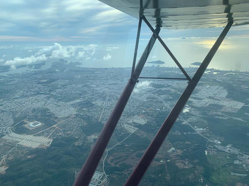
Have a close look. Hard to see. Nogales airport is only a few miles from the border, so I had to circle to gain altitude before crossing it in order to have a chance to reach Mazatlan on VHF, but it was nevertheless unsuccessful. A friendly airliner helped with a relay, but Mazatlon told me (via him) to contact Hermosillo. And as there was nobody on that frequency, I flew in radio silence for an hour or so, until Hermosillo Approach finally talked to me. It wasn't a problem.
As expected, my instrument only has a US database. Therefore, no more waypoints from now on.
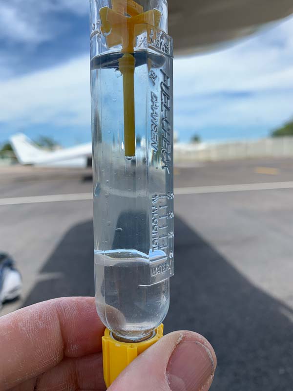
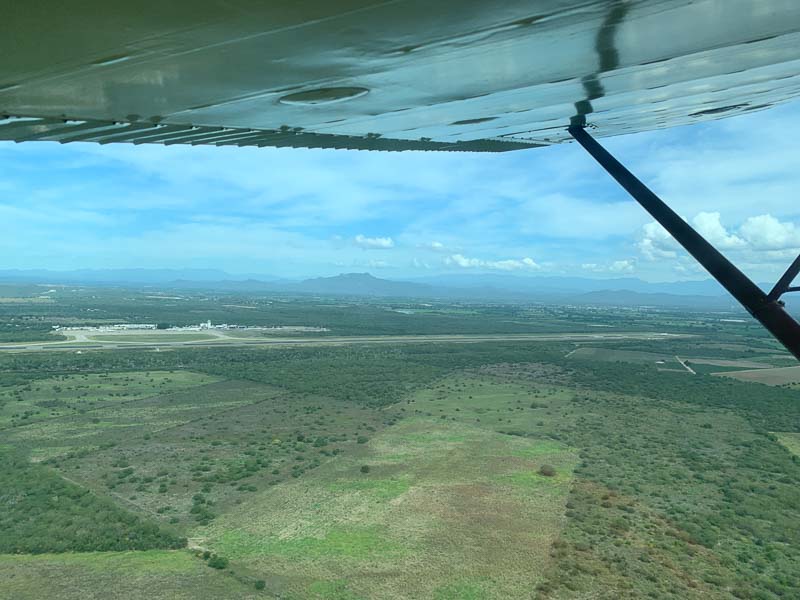
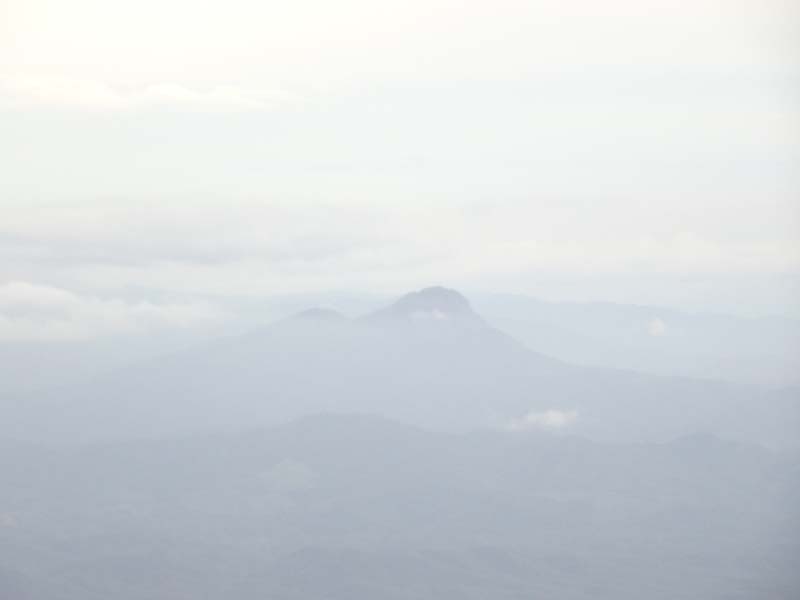
Hermosillo, in the distance, behind the hills. A large city, I have never heard of before. After landing, I was approached by a guard, capturing the basic data. Who am I? Where do I come from? To immigration. Purpose of the visit: Crew or tourist? I said I am a tourist, but they insisted, I am crew. Being crew, I only got a restricted permission to stay. How can I do a long vacation this way? First, I had to close my flightplan. With the folks in the US via my cellphone (which worked) and with the locals via a form which was signed, stemped and copied multiple times. Customs searched my plane. What is in the gas tanks? Well ... Avgas! What do you need it for? I explained that there are airports in Mexico which don't have Avgas, only Jetfuel. They allowed me to import the Avgas. Could be an issue at every border. A sandwich? An apple? They have to stay in the plane! I promised to eat them right away. (I was hungry anyhow) They checked and copied all my documents. I even had to show the old airworthiness certificate from 1956. (The plane is from 1947, but it had another registration number before 1956). Insurance document only valid until February 1st? I better get a paper copy of the new one, which has just arrived in Germany. How do I pay for the multi-entry permit? There is no ATM in the General Aviation terminal. The friendly officer drove me to the passenger terminal. (Hermosillo is a big airport with airliner traffic). Equipped with Pesos, we drove back and continued the procedures. All in all it took me more than an hour. With more experience it would be quicker, maybe 30 minutes? I was allowed back to the plane but had to promise not to fly without filing a flight plan. But all I wanted was securing it for the night. A fuel truck came. How many liters do you need? Liters! not Gallons! "Fill it up, please" As usual, they overfilled, spilling the fuel on the fabric wing which is not good. I'd prefer to do it myself. I must confess, it is tricky to fuel the 140. You have to have experience and hear the rising fuel in order to avoid overfilling it. Insiders use a towel to avoid wetting the fabric. How do you pay? Yes, we accept Visa. Fuel costs 1.2 Euro per Liter, cheaper than gas for cars in Germany. After last night's experience, I carefully booked my hotel. Uber is legal in Mexico and driving downtown to my hotel was cheap. I only did one 2-hour flight today, but I am tired now ...
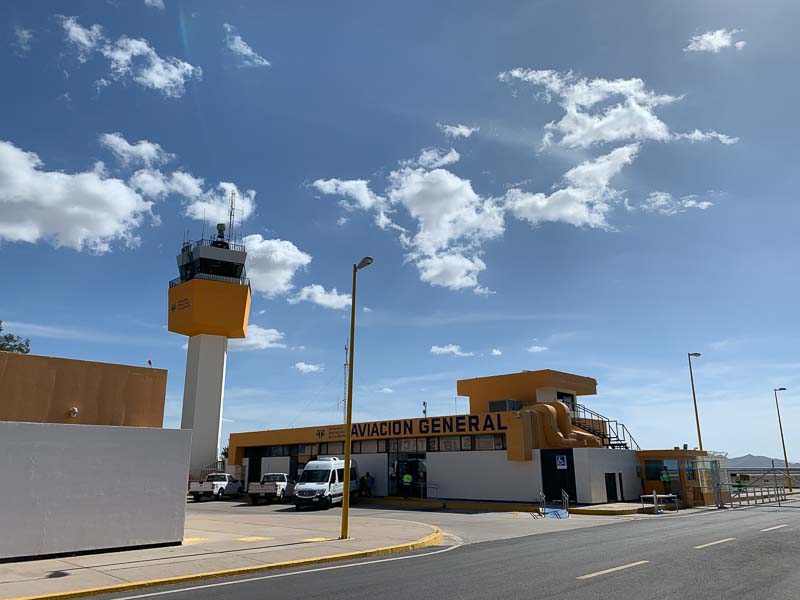
I slept well in the IBIS Hermosillo. Breakfast was excellent, much better than in most US motels costing twice as much. Took a taxi to the airport, but it was a mistake. It costs twice as much as Uber and taxi drivers often don't have change. Which airline do you fly? Well, to the general aviation terminal, please. I filed the flightplan digitally with Foreflight. Foreflight sent me an automatic email saying, that they are unable to verify if my flight plan has been successfully processed by ATC. Well, it was, but apparently Mexico ATC doesn't confirm this to the Foreflight server. Digital filing is still not common in Mexico. Where is your (paper) flight plan?, asked the guard at security. When I told him, I filed digitally, he let me pass, but a minute later he called me back. I haven't payed my landing and overnight parking fees. When paying airport fees you get a stamp on your departure flight plan. Without stamp, they won't let you pass. But when filing digitally, there is no stamp. The process doesn't work anymore... Landing fee was 87 Pesos. Minimal parking fee is 29 Pesos. For the overnight parking I had to pay an additional 70 Pesos. Totals to 186 Pesos or 11 US$ or 10 Euro. After takeoff, turn left on course. Up to now, I always flew in Airspace Delta, which means that I have to talk to Controllers and fly as they clear me (as long as this keeps me out of clouds and other trouble). But they didn't tell me much.
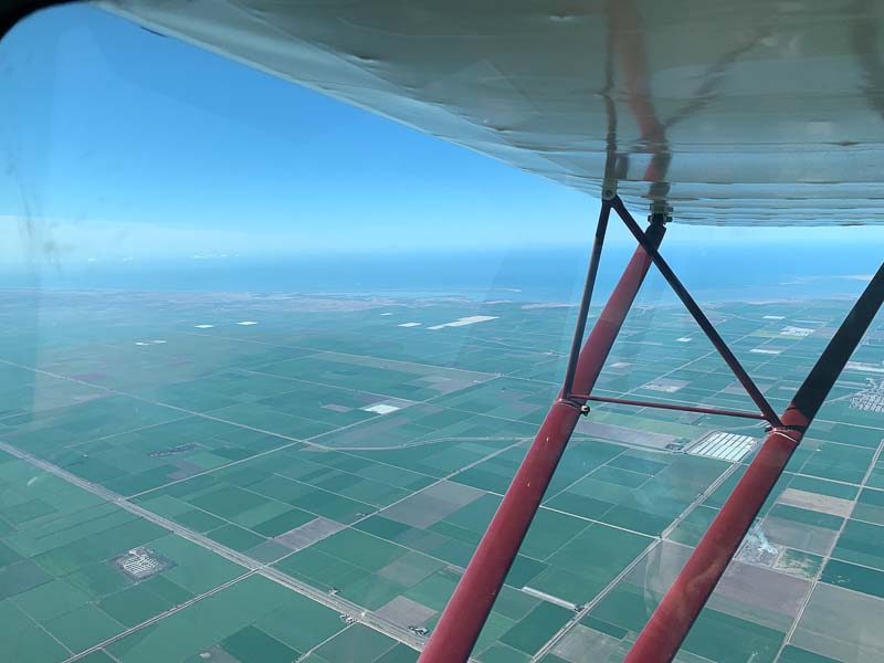
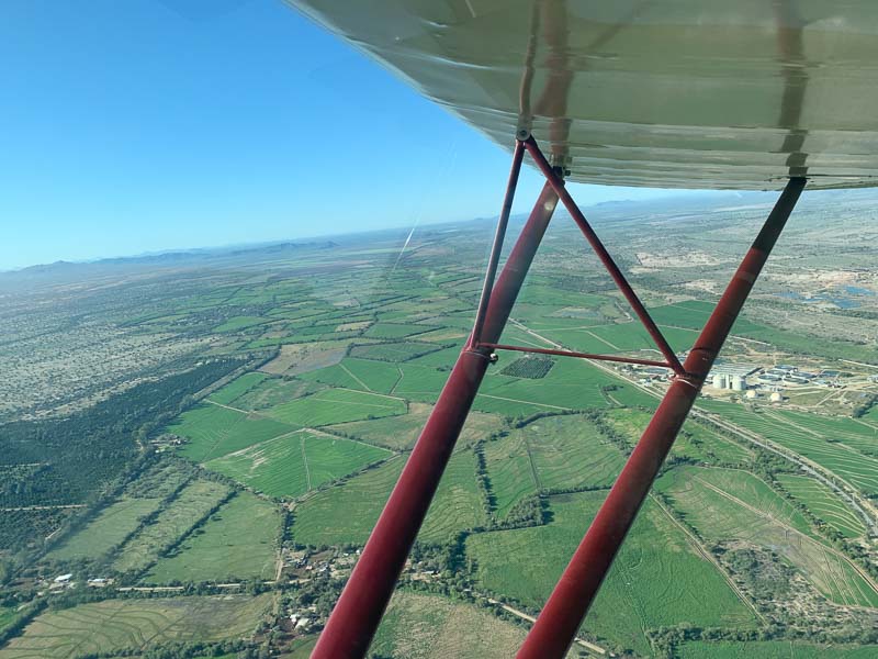
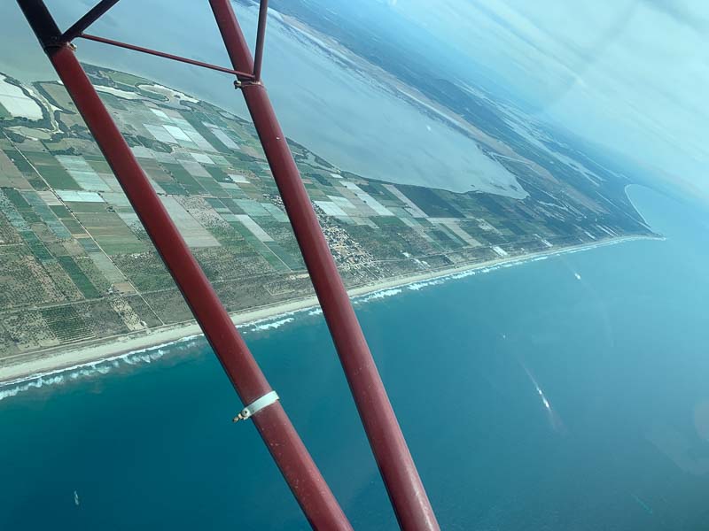
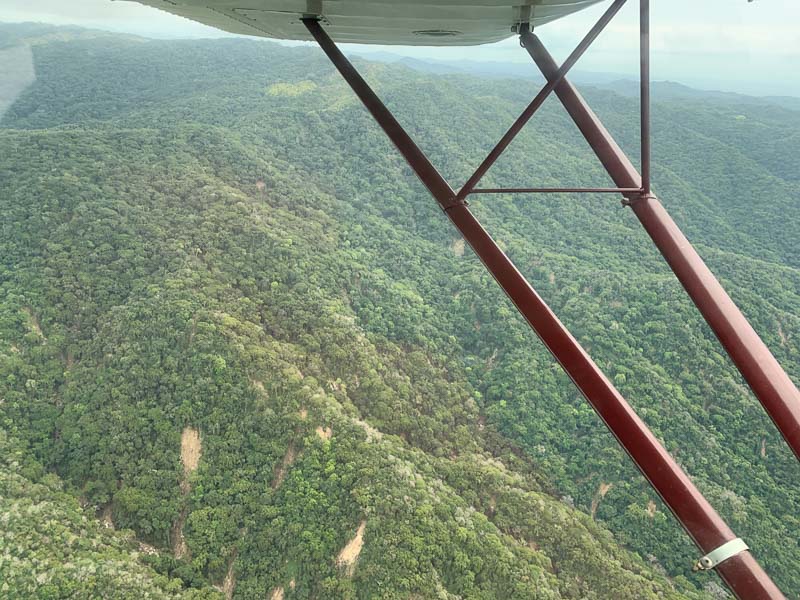
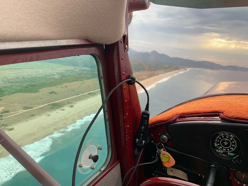
Look at the pictures! The fields are nice and green and finally, I saw the Pacific.
Please remember, I took off in California, but never saw the coast. Here it comes and it will not go away for a long time.
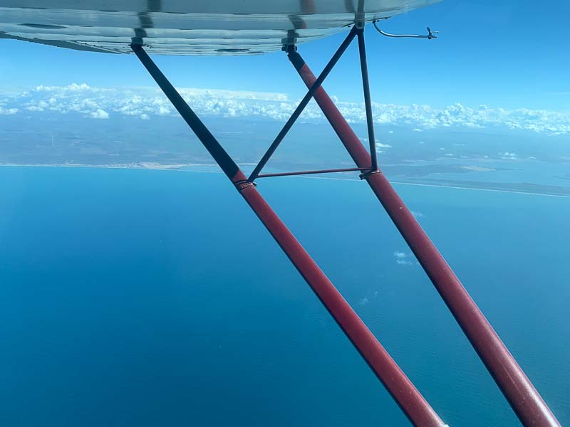
In fact, I flew over water. But I stayed close enough to the coast to be able to reach it, when the engine quits. Most of the time, the beaches were sandy and empty, promising a good emergency landing surface. Hopefully, I never have to test it. For beach landings, the bigger tires would have been better.
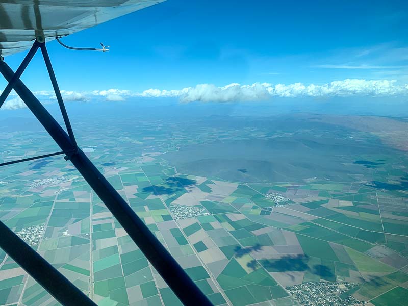
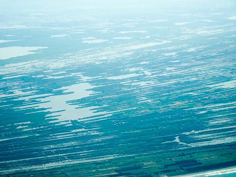
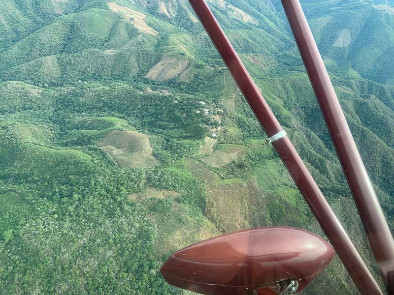
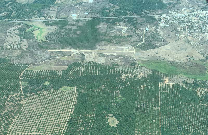
The fields look clean and tidy. Similar to fields in Germany. ;-)
After a 2.5 hour flight, I landed in Los Mochis. Actually, the airport is located between the town of Los Mochis and Topolobampo, where the passenger trains from Chihuahua arrive and people transfer into the ferry to La Paz on Baja California. In January 1990 I did this train journey, it is one of the most spectacular train rides in the world. They worked 100 years to complete the tracks through the mountains, from 1861 to 1961. The airport was modern, clean, similar to Hermosillo. I ate lunch in the cantina. Filed a (paper) flight plan to Mazatlan, paid my landing (87 Pesos) and parking (29 Pesos) fees. Same fees as in Hermosillo, same airport operator. Problem is, nobody has the Cessna 140 in the computer. So they don't know the wing span and the weight and can't calculate the fees. They have to look it up and this takes time. I waited 30 minutes, until I was able to pay my 6 Euro. And with a paper flight plan I got all the stamps. This procedure works. Believe me, they try hard, but it is not easy to go digital. :-)
This second flight today was even longer than the morning flight, 2.7 hours, my longest Cessna 140 flight so far. Endurance is about 4.5 hours, but the problem with flying longer than 3 hours is that you need reliable winds or suitable en-route alternates in case the winds are worse than expected. In the USA, Foreflight knows all the winds, but here I have to collect them from the wind charts. Old school. Due to the slow airspeed of only 75 knots, even small wind changes are critical. There are many small airfields, but they are all marked as private. I guess, they should only be used in Emergencies. Therefore, I plan conservatively, if possible below 3 hours.
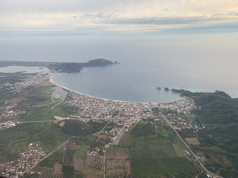
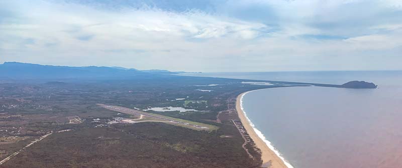
Mazatlan appeared in the distance. The airport can not be seen in this picture, only the old town (left) and the endless beaches. Mazatlan is a popular place for vacations. Tower asked me to make a short approach, because an airliner full of tourists was waiting. I showed them the short approach Brian has shown me: Flying directly towards the threshold, wasting half of the runway, because the other half is still three times too long for me and taxiing to the first turnoff would be endless. 5.2 hours total flight time today, not bad.
Uber said "No cars available". Downtown is 40 minutes away. A taxi would have been expensive, I decided to take a "Collectivo". Bad decision. It took nearly 2 hours, until he had delivered all passengers to all their hotels, I was the last.
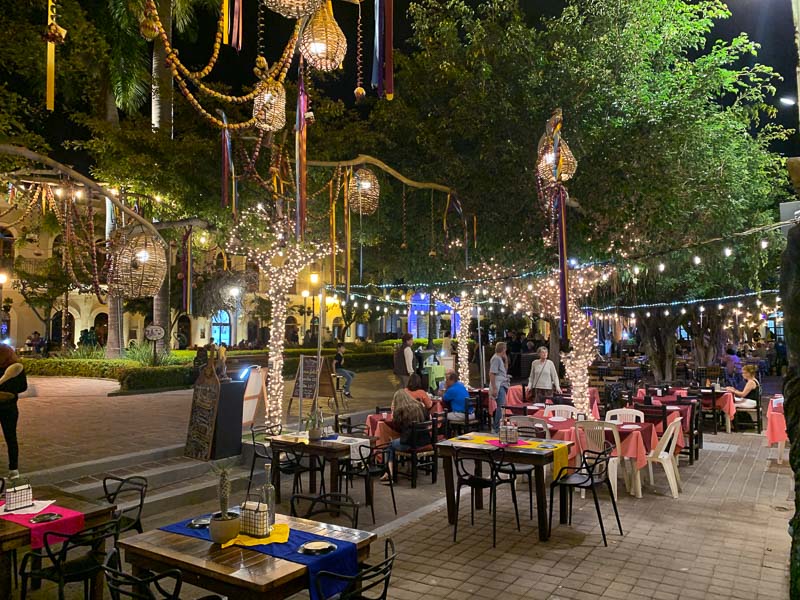
After the Ibis last night, I wanted something fancy and booked a downtown hotel. The picture is taken from the hotel entrance door. It is super small, maybe only 10 rooms. It is an antigue building, but nicely rennovated, like the surrounding streets in this amazing area. I walked around, absorbed the mexican vibrations. Strangely, the tourists didn't disturb the flair; they fitted in.
After last night's experience with the "Collectivo", I tried Uber again. A driver accepted the trip to the airport, arrived and drove a mile and then decided, that he can't go to the airport. I think that he is afraid of the local "taxistas". Trying to help him, I offered to be dropped off half a mile away from the airport. But he insisted that he cannot drive me. Don't they check their destinations, before they accept the trips? I took a taxi. When approaching the airport, I saw that a taxista was noting all the cars going to the airport, probably looking for Uber cars. Taxi drivers fight Uber all over the world.
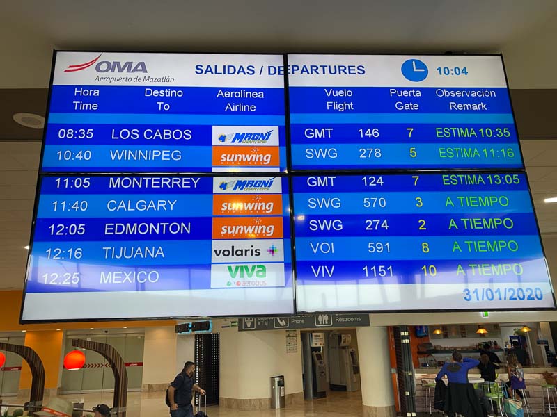
The taxi dropped me at the passenger terminal. I needed WIFI and in the pax terminals, they usually have it. It wasn't free, but fast and allowed me to do some updates and brief for my flights. Look at the flight monitor. It must be awful in Canada in winter!
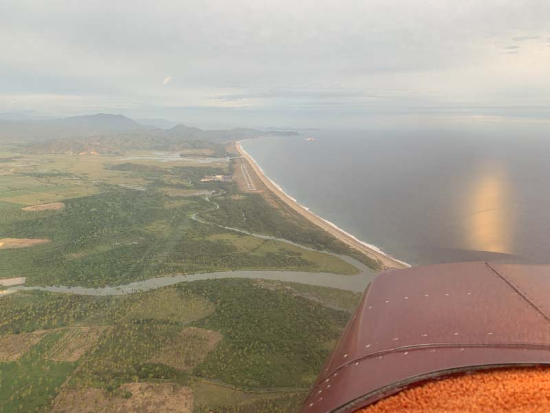
Had to wait a long time for the fuel. Mazatlan is a busy airport. If possible, I'll try to get fuel after my flight, not prior. Airliners decide the fuel always last minute, taking what they need. I always fly full tanks. (At least here at sea level without performance issues and without a passenger.) So why not fuel in the evening? I used the time by practicing checking on Ethernol. Of course, there is no Ethernol in mexican Avgas. But I may have to use auto fuel further south and that may contain Ethernol, which my STC doesn't allow. That reminds me of Brian telling his students not to buy a plane with mogas STC. People who have it, try to fly cheap. They may have tried to save on maintenance too.
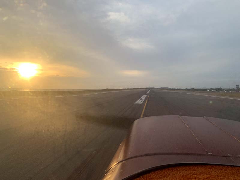
After take off in Mazatlan, left turn on course
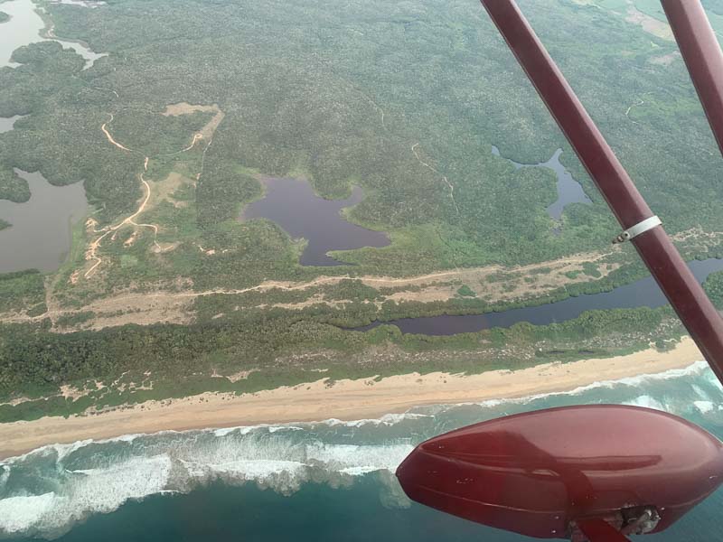
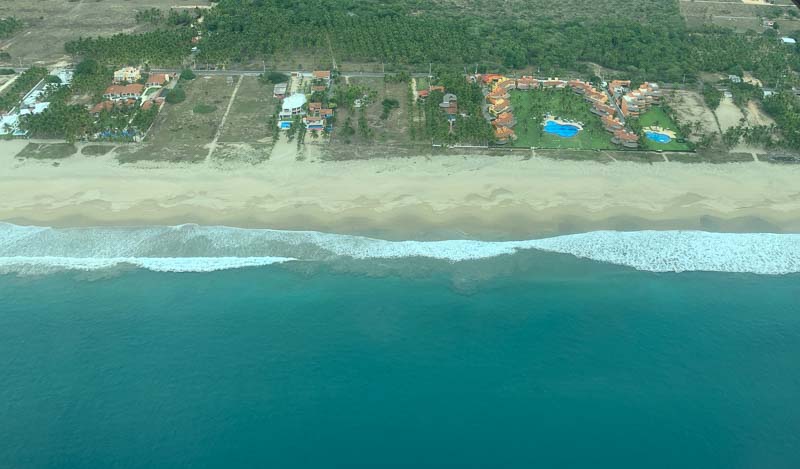
Long, sandy beaches
Behind the beaches, often strange landscapes
It is getting warm. In California, I initially worked and flew with 6 layers of clothing, including a down jacket, Mike borrowed me. Remember, there was ice on the wind shield of my car (and plane). But now it is warm. I began to fly with open windows. Not always, I am still afraid of something being sucked out. Luckily, there is no paper in the cockpit. :-)
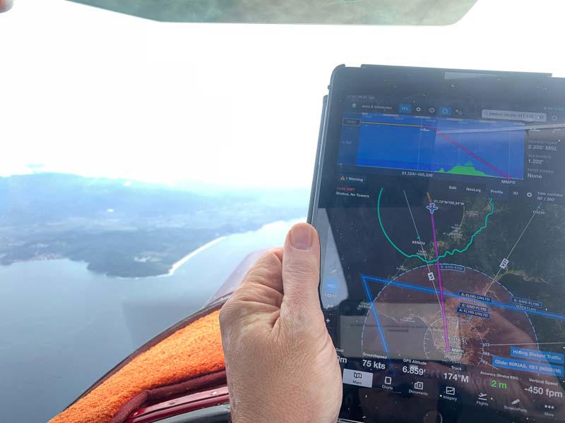
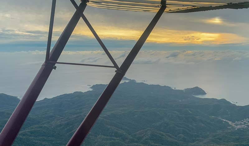
Terrain is a concern. Not when cruising along the coast, of course. But the airports are often situated in valleys and there are many scattered clouds today, blocking the strategic view. If you use Foreflight, I strongly suggest to pay the extra money for the profile view. It enhances situational awareness.
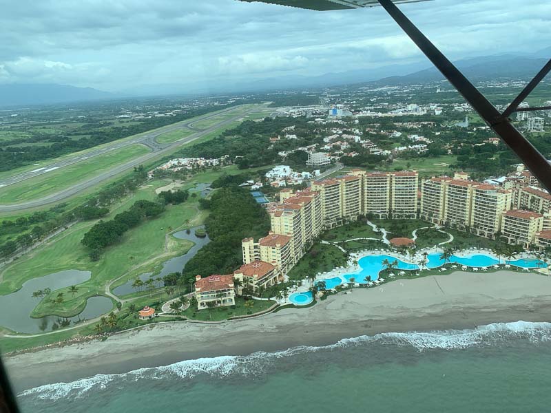
Puerto Vallarta must be behind that mountain
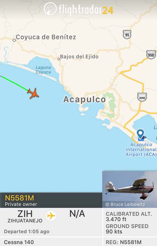
Guido showed me, that my flights appear in Flightradar 24
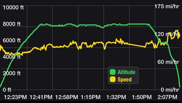
Well, I guess, everything is transparent nowadays. The graph below shows that I was never faster than during approach. This is typical for the 140, it can only be fast during descent and you usually land without flaps, white arc no factor. Here additionally, the tower asked me to stay fast, there was an airliner behind
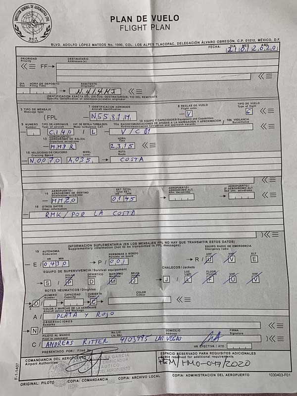
I have never seen "V" in field 10 of the ICAO flight plan, said the man at AIS. "V" stands for "VHF only" with no navigation equipment, while nearly everybody here files "S" (= Standard), which includes VOR, ADF and ILS. Well, I don't have VOR, ADF, ILS and all this fancy stuff, but I do have a non-certified GPS, does this count? I looked it up and it seems, as if I should file "VG" next time. Which Route are you going to Manzanillo?, he asked. Direct? No, along the coast. He nevertheless entered "DCT" in his computer, but added RMK/POR LA COSTA in Field 18.
After AIS I went to the "Commandancia de Aeropuerto", who checked my Multi-Entry-Permit as usual. Next was paying the landing & parking fees in the third office. What type of Cessna? 140? Never heard! Sure, it is not a 150 or 172? He didn't find it in his computer and asked for the weight. 404 kg? He laughed and gave me the stamp without asking me to pay. Probably, he had never had such a small aircraft on his airport. Back to AIS, where that gentlemen checked that all stamps are on my Plan de Vuelo. He phoned the tower that I want to fly along the coast and allowed me to go
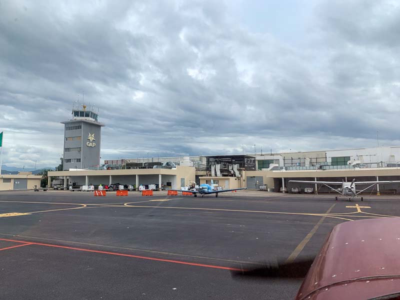
All this paperwork took only 30 minutes; I am getting used to it. Total time on the ground in Puerto Vallarta was 1 hour. It is the biggest airport I have been with my little plane so far. Taxiing out, I passed an A330 from Air Transat, three A320 waiting for departure. I felt at home, the R/T was so much easier to understand, than in the US, with all these native English speakers flying around. How many minutes wake turb separation light behind medium? Tower allowed me to take off ahead of them and I cleared the upwind with a quick left turn. They didn't have to wait long.
The airport of Puerto Vallarta is located directly in the city, facing the beach.
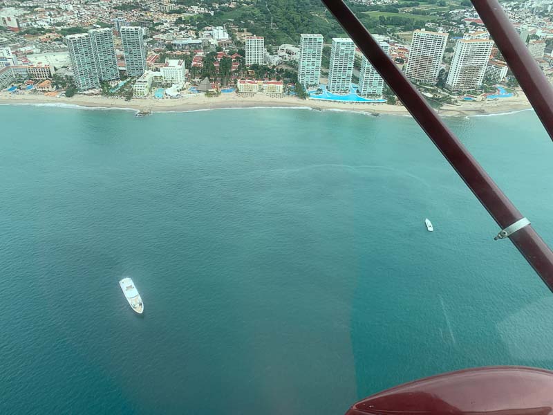
Many nice hotels. Modern rooms for all the tourists coming with all the A320s and A330s. Not my taste.
Cloud base was at 3000 feet, I had to stay in 2500 and continued along the coast
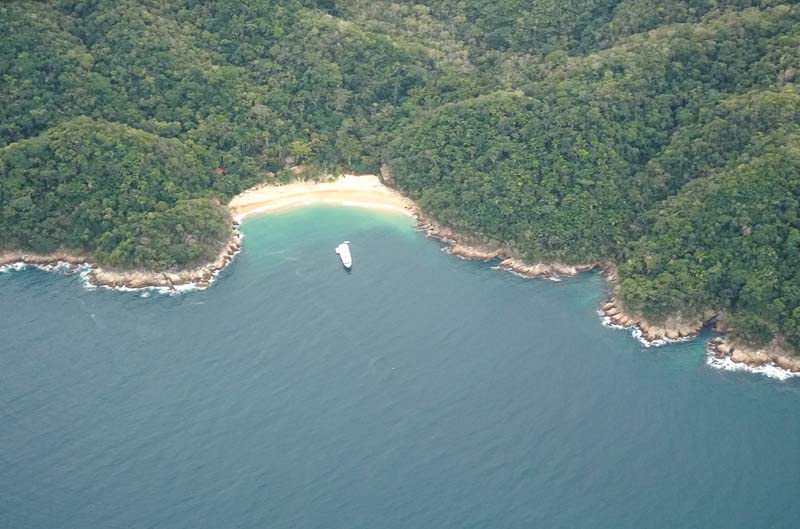
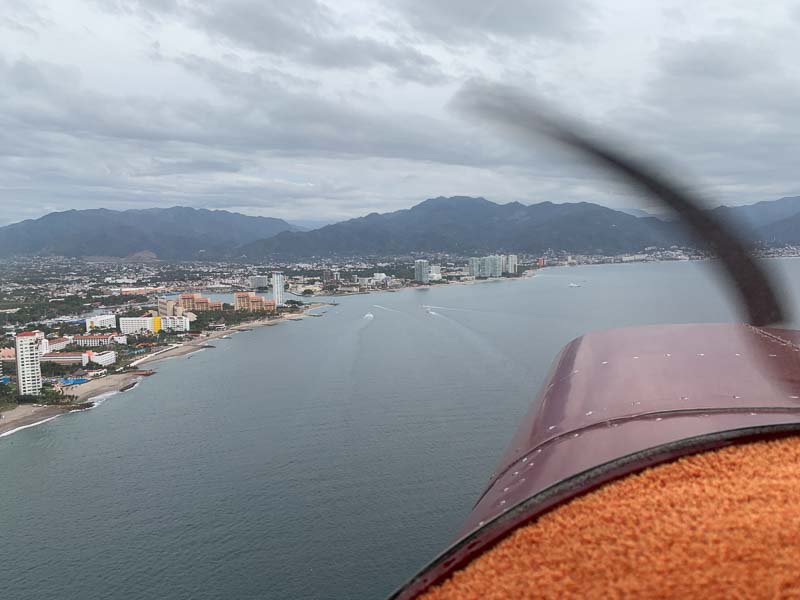
Flying along the coast is nice. You can see how the millionaires spend their time
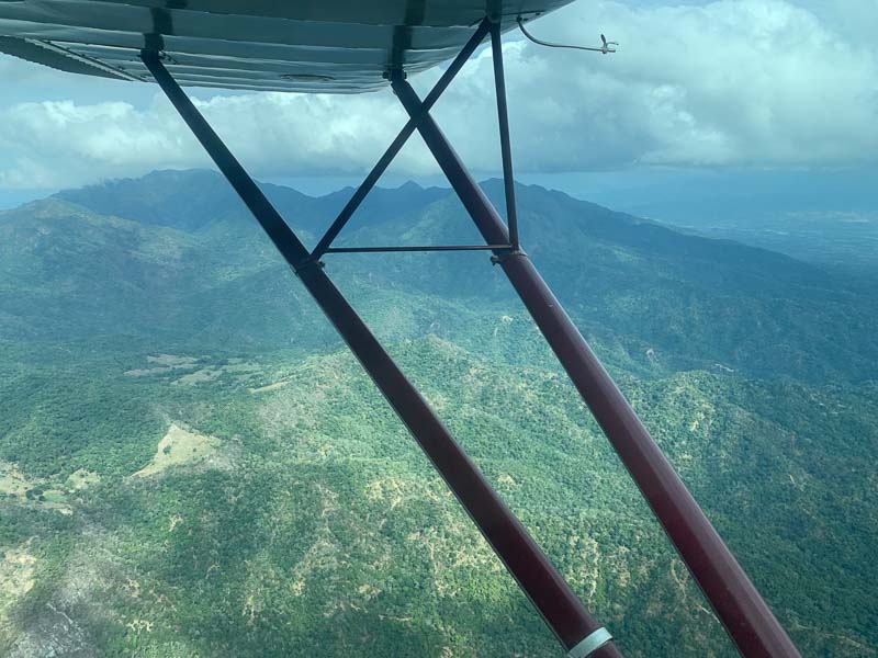
No chance to cross the peninsular, the mountains are obscured in clouds
Flying low is beautiful. Lots of nice views
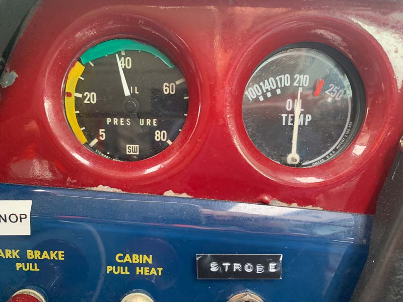
But it is warm down here. The oil temperature quickly rises beyond 210 Fahrenheit. Yes, this 50+ year old gauge is accurate, I checked it a few months ago with a digital thermometer. Flying prolonged with 210 or more (max is 230) is not good for the engine. One sign is, that it burns a lot of oil. Had to add nearly a quart to compensate today's five hours' flight time.
Night VFR is forbidden in Mexico, but my destination isn't far anymore.
This is Congreg San Patricio, 30 km north of my destination and I thought I might find a nice hotel here
Approaching the Aeropuerto International de Manzanillo
Left Downwind 28. They cleared to land me 20 minutes ago. Not much traffic here.
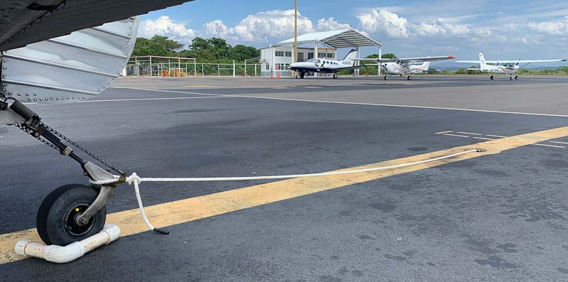
On the ground in Manzanillo. Many free parking spots, but only one of them had the rings in the ground I need for my tie down ropes. (Never fly in Mexico without bringing ropes. Tie down nails/claws not used, so far)
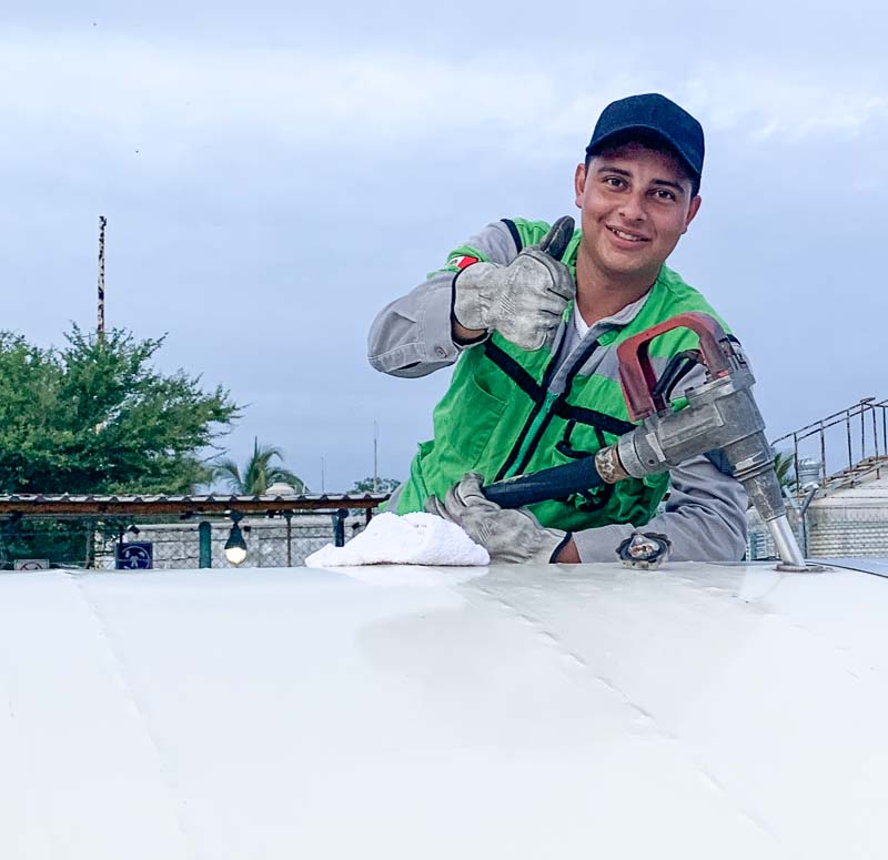
Everybody is VERY friendly here. It is low season, not much traffic, people are not in a hurry and very helpful. This young gentleman was the first who managed to fill the 140 tanks without overfilling them. Despacio, despacio!
Some planes have been waiting here a long time for their next take off. It can be felt and seen; we are in the tropics now. Manzillo is 19 degrees northern latitude, I started in Red Bluff at 40 north.
February 1st, I didn't fly, but spent the whole day in Manzanillo. Flight progress in the last days was good and I had to catch up with a few things. Nice hotel, but no WIFI. Went to a cafe, to load aeronautical and geographical databases of some central American states. Deleted databases of the USA to make space; I won't need these databases anymore. Even with 128 GB, tablet space is a concern. Spent 3 hours in the cafe, because downloading all these databases took so long.
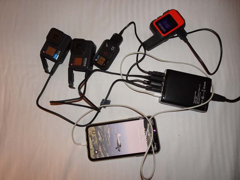
I have only one 110V charger to charge my devices. Not only to save weight, but because some hotel rooms have only one free power plug. But my charger can charge up to 5 devices simultaneously and I sometimes need this feature, as I have 8 PEDs. (phone, 2 tablets, small super-zoom camera, 2 GoPros, GoPro remote, sat phone). In the aircraft, a USB charger in the 12V "cigar lighter" delivers 2.2 Amps, sufficient to keep the tablet charged. Additional power source is a large power bank. I have 4 cell and 1 iridium contracts in 4 devices, but usually only 1 cell contract gives me mobile data. The iridium is only for emergencies.
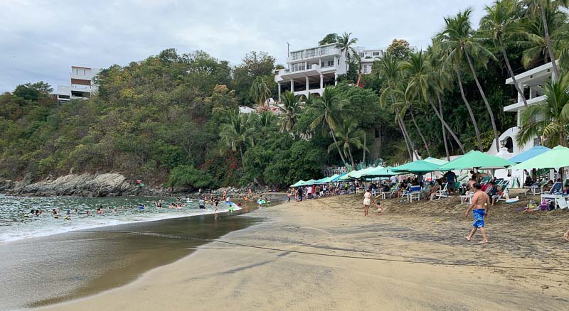
Manzanillo has a big harbor. When one of the cruise ships is in port, the city is flooded with tourists. Otherwise, there are mostly locals. As it was a Saturday, the beaches were quite full.
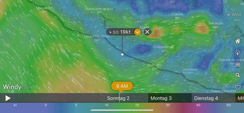
To improve my wind awareness and trip fuel calculations I started to use "Windy", which presents winds very appealing.
February 2nd: It was still dark, when a taxi drove me some 40 km back to the airport. Arrived there at 7:30, but I had to wait until 8 AM to be able to pay my bill. Had to refill some brake fluid, engine oil and extend the runup until the aircraft was in a satisfactory condition.
After take off in Manzanillo, following the beaches
The leg to Zihuatanejo was 3 hours long, longest flight so far. Manzanillo Tower told me to contact Zihuatenejo Tower, when able. For nearly 2 hours, I wasn't able. When flying in 3500 ft along the coast, I can usually talk to a station which is up to 50 nautical miles away. Theoretical line-of-sight range would be 61 nautical miles.
Approaching Zihuatenejo. Descent is always own discretion. Tower usually wants a to know the distance to the airport with first contact (about 50 miles out) and asks for a report when 10 or 5 miles out and then wants a report when abeam the tower. I never got a base entry, always a downwind entry.
Turn around in Zihuatenejo would have been quick, but I forgot to hand over the flight plan copy with all the stamps, therefore tower didn't have my flight plan and I had to switch off the engine and walk back to AIS. After take off in Zihuatenejo, again following the beaches.
Foreflight doesn't show all the emergency strips, AirNavigation does. This is Las Bodas. It is 345m long and 10m wide. Good to know.
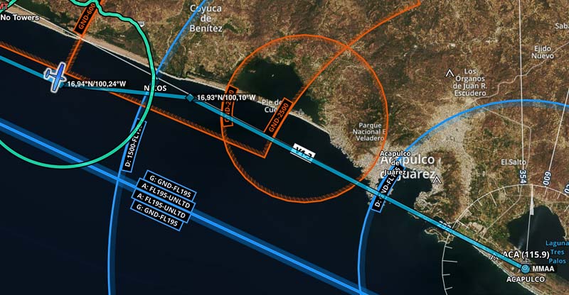
Approaching Acapulco is certainly one of the highlights of this journey. But there are some tricky restricted areas, just north-west of it.
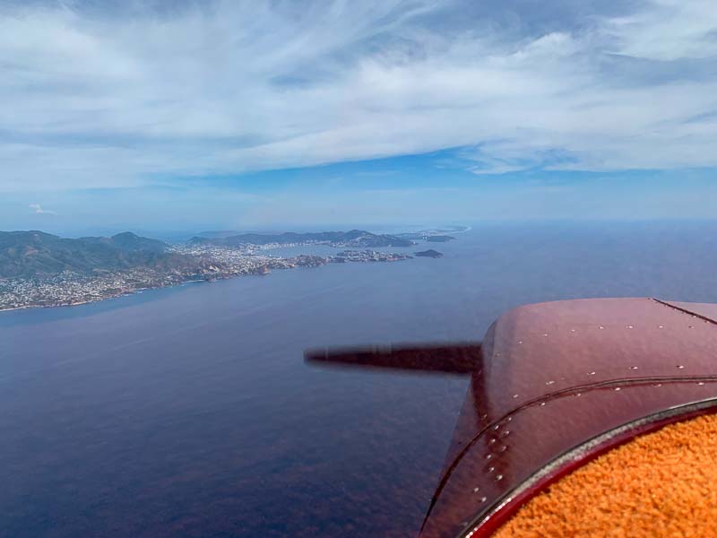
Then, the beautiful natural harbor appears in the distance
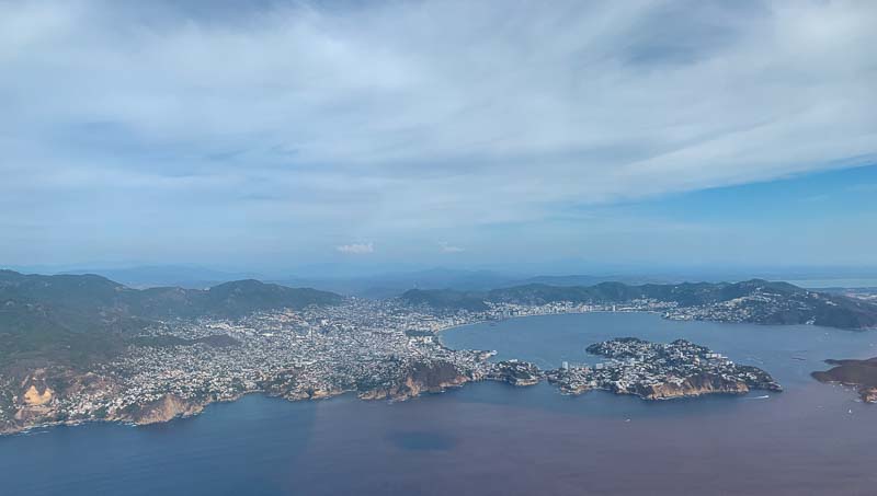
The airport is behind the city
As usual, the gang at home followed my ADS-B signal
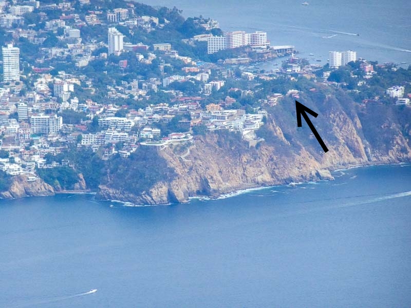
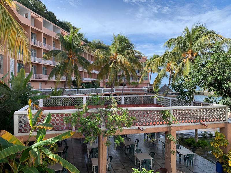
The arrow points to my chosen hotel. The "Los Flamingos"
Apron in Acapulco was full. They sent me to an overflow parking area in front of the passenger terminal with no tie down possibility. This is not good for a tail wheel aircraft, where the wing is more sensible to gusts as in the case of nose draggers. This picture is taken one day later (February 3rd), when I returned to the airport just to taxi to a position with tie downs. As you can see, the rings are far apart. Bring long ropes, if you fly with a small aircraft to Mexico.
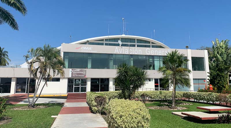
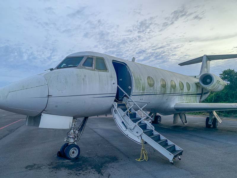
The General Aviation terminal is beautiful. Big, modern private jets parked in front.
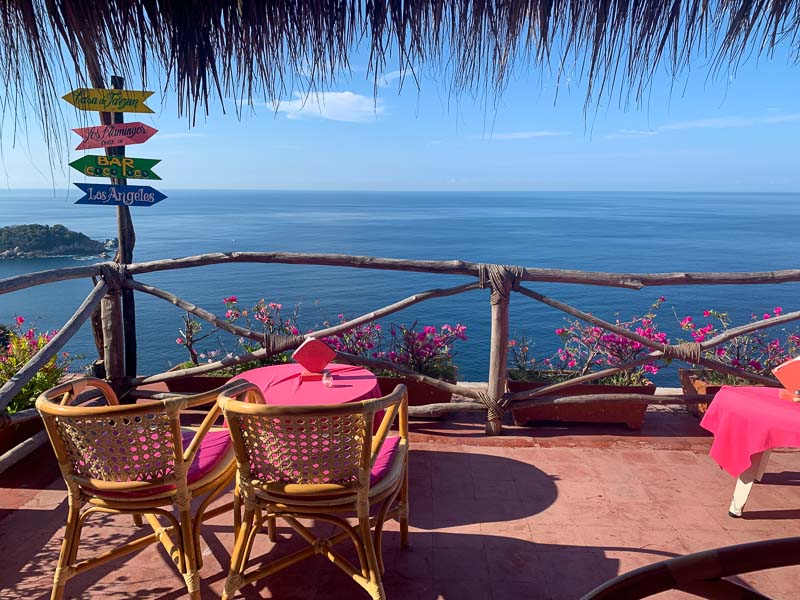
Enjoying "Los Flamingos"