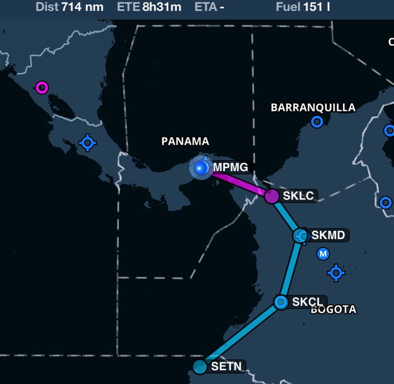
I didn't fly on February 21st. Spent my time doing some flight planning for the difficult Colombia part. Ibu, Gustavo and the other pilots from Panama's AeroClub forwarded contacts in Colombia to me and with the help of these colombian pilots I plotted possible courses in Colombia. The map above shows how I intended to fly, not how I actually flew. And I looked after my plane and got it fueled for the next flight. They didn't accept my credit card at Gelabert (MPMG) airport, had to pay the fuel with cash.
In the early hours of February 22nd I went to the terminal and looked for AIS. But I was told that it was closed, as it was Saturday. So I filed my flight plan via phone, pre-flighted the aircraft and contacted Gelabert Ground for taxi. Unfortunately, neither Foreflight, nor AirNavigation has taxicharts showing the taxiway names. Not an issue on most of the airports I flew so far, as they have usually a rather simple taxiway layout, but Gelabert is somehow bigger and therefore I had to confess that I am unfamiliar with the mentioned taxiways - something I try to avoid. But they were friendly and soon the run-up was completed and Tower cleared my for take off runway 01.
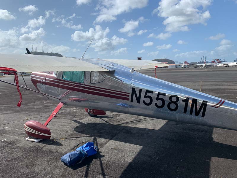
There are hills in most sectors, but it was still cool this morning. Here at sea level and with only one person on board, the 140 climbed (nearly) like a jet.

Tocumen (MPTO), Panama's largest airport, is located 10 miles north-east of Gelabert. Panama Flight Watch cleared me initially direct Tocumen VOR and I envisioned a mid-field crossing in about 2500 ft. But then they cleared me to fly along the coast line, so I passed 3 miles south of Tocumen. 10 miles east of Tocumen, they advised me to contact Panama Radio and let me fly directly to my destination.
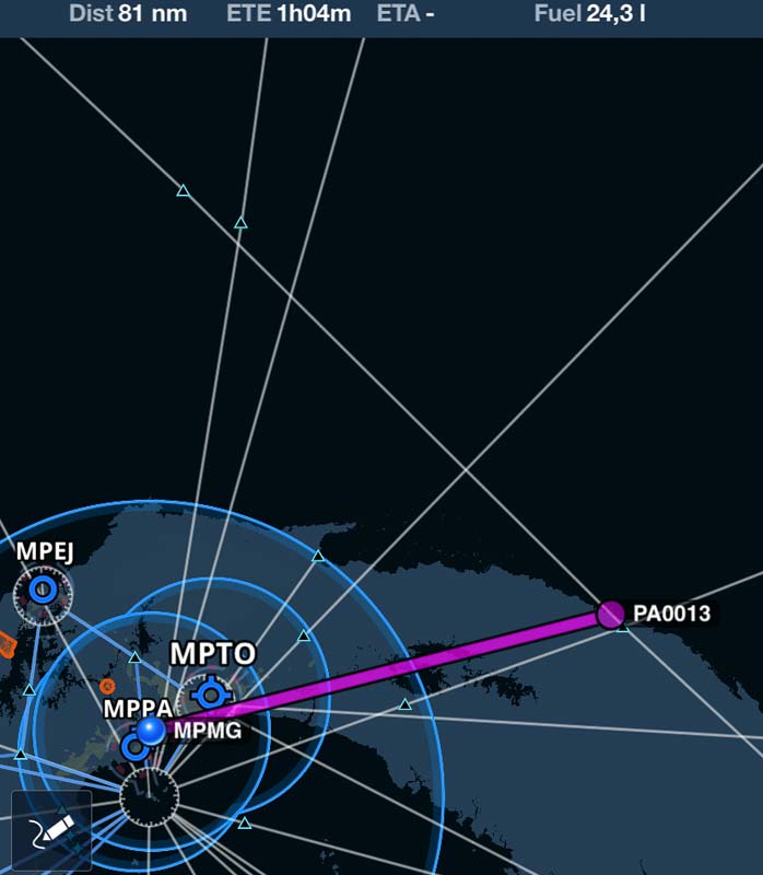
Which was Playon Chico, MPPH. For some reason, small airports like MPPH are not in Foreflight, only in AirNavigation. At least not with their ICAO code. Foreflight knows an airport with the code "PA0013" located where AirNav locates MPPH, but nobody else knows PA0013.
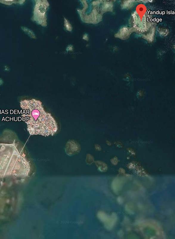
As always, I had tried to get as much information about my destination as possible. Google Maps had a good satellite picture of the northern part of the airport (left side of the picture, below the village), but not of the southern part. So how does the approach to runway 02 look like? I found a video on Youtube showing it. Wikipedia has some info. Somebody knows something. And so on. After some time, you get the picture. Uncontrolled. Concrete. 600m long, 10m wide. Close to the coast. Surrounded by high grass. Apparently, no infrastruture. Not connected with good roads. Air taxis fly there to bring guests to the beautiful caribean resorts nearby, e.g. the Yandup Island Lodge. My plan for this morning was to land there and check it out; see, if I should book it for a one week family vacation.
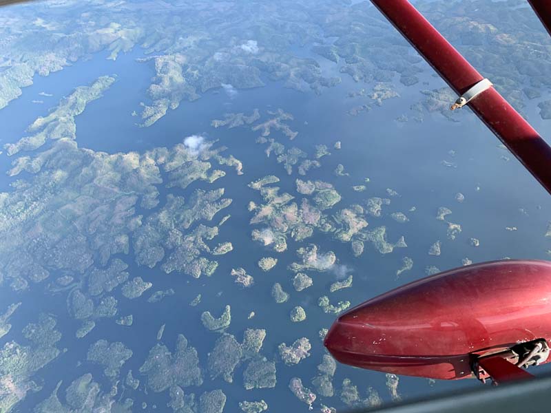
A few minutes flight time north east of Tocumen, signs of civilization get rare. Not many streets or western villages here. I overflew Lago Bayano, apparently an artificial lake which had flooded parts of the jungle. Flight was planned in 5500 but there were many clouds, so I decided to climb. First to 7500, later to 9500. Weather at destination? There is no report. Next airports with reports are Colon and Tocumen, but they are 100 miles away and have a different geography.
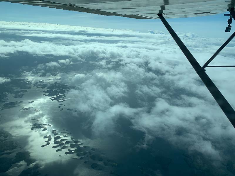
Climbing above the clouds was a mistake, they got denser and finaly were like a wall, I didn't find a hole to get legally below them again. As some clouds where higher than 10000, I had to circumnavigate them, increasing my flight time. I had planned to do the flight without refueling and my jerrycans were empty, so I couldn't do much more than 90 minutes one way. I knew (and saw) that the clouds did not extend much beyond the cost line, but judged that I didn't have the fuel to fly that far out over water to the north. Besides, I flew (again) without life jacket. The decision was easy: Return to Panama City. Panama Radio was happy with this too, so I flew back to Gelabert without having seen Playon Chico. Which meant, that I didn't go there with the family either. What a pity! Should have stayed below the clouds.
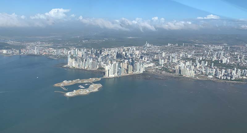
When Radio handed me over to Flight Watch they advised me again to fly along the cost, passing south of Tocumen. That gave me a nice view of the downtown area.
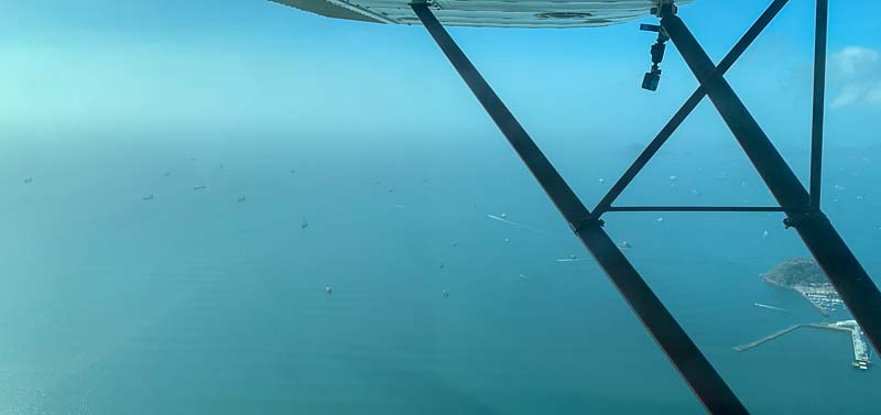
Looking left, I could see the ships waiting to be allowed to enter the canal.
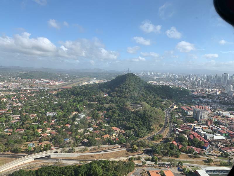
After I reported field in sight they cleared me directly to the field and asked me to contact Gelabert Tower. When I approached Gelabert two days ago, I came from the north, now I approached from the east. There is a hill right where you would turn in for base, so (at least that was my judgement when I eyeballed it) there are two possiblities: Fly a base directly to the threshold (and make a 90 degree over it). Not an issue for a 140, but maybe uncomon at a controlled field. Or fly south of prohibited area one and that hill and make a 3 miles final. I chose this more conservative approach.
After landing, I taxied back to the AeroClub, tied the plane down for 9 days of parking and walked back to the Albrook Inn. Just in time for breakfast.
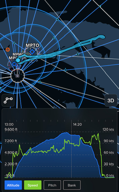
Picture above shows, how I actually flew