It is a beautiful day. I decide to stay in Ovalle. After some administrative work in the morning, Club president Marcello picks me up for lunch.
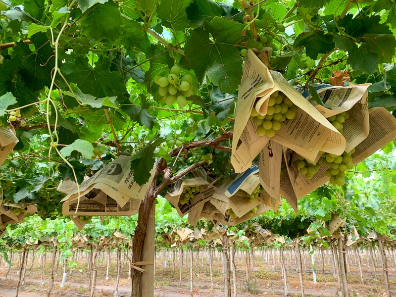
He shows me the fruits grown in the valley: Grapes, Avocado, Walnuts. Chile is a large exporter of fruits:
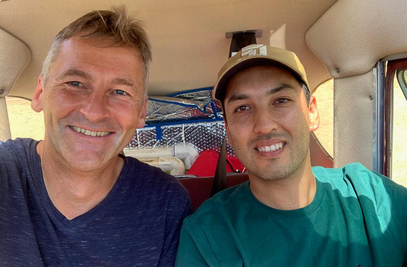
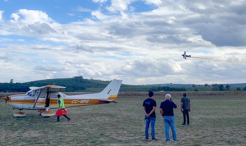
After an excellent lunch, Karim, a young pilot with a fresh PPL, joins me for some tailwheel fun. He is impressed by the instability of the 140, you constantly must work with the rudder to keep the bird straight, especially while the tailwheel is on ground:
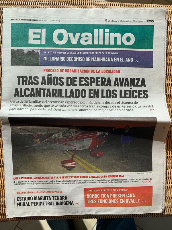
Evening comes and with it another invitation. Roberto picks me up for dinner. We have a fantastic evening together. Then, he drives me back to the airfield where a journalist from local newspaper El Ovallino interviewed me about my trip. I am the local headline of the week:
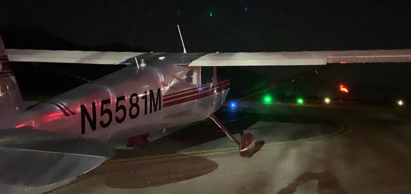
Afterwards, I practice some night flying, utilizing that Ovalle airfield is equipped with night lights. There are not many airfields like Ovalle in Latin America:
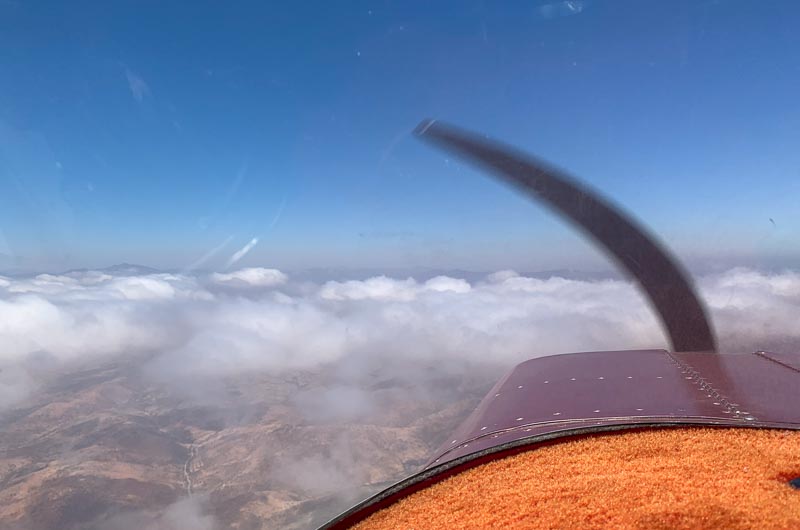
The morning starts foggy. After a while, the fog lifts and becomes low clouds. The mountain tops, not more then 1000 feet above the airfield elevation, are in clouds. The coastal airports La Serena and – further south – Valparaiso, report IMC:
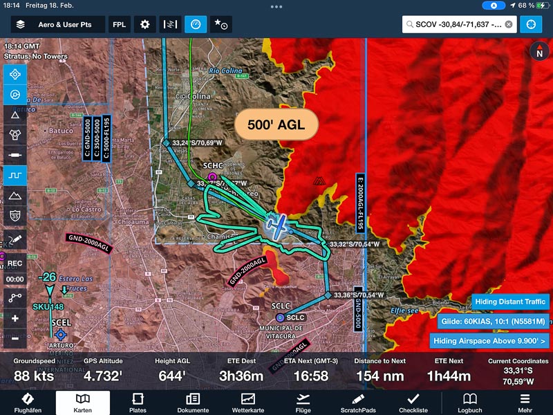
I do things slowly, leave the hotel, walk to the airfield, repack my stuff – and find my missing GoPro. I missed it for a week. Roberto appears, asks if I need anything, but the only wish I have, is that the clouds dissipate. They won’t. After a few hours of waiting, I change my route. Instead of over the mountains, I plan along the coastline. A safer route when it it is cloudy. However, it is 30 minutes longer. And there is another downside. My destination is not on the coast. If the clouds are not gone by the time I overfly Valparaiso, I have to land there. I won’t make it to Santiago’s little airfield Vitacura, my goal for the day.
I don’t want to wait anymore, start the engine and fly towards the coast. Just below the clouds. Just above the hills below me. Flying that low, I have a hard time understanding La Sarena Approach. The voice is lost in the background noise. Just before the coast appears, the sun comes out and offers the chance to climb legally above the clouds.
I know that the cloud layer is thin further south, so the risk of climbing above, is low. Radio communication is better now, but they insist on speaking Spanish. In the last days I was mostly communicating with real air traffic controllers (ATC), not with flight information services (FIS). It seems that FIS speaks only Spanish, while ATC speaks English too.
Clouds completely dissipate now, so I give up my coastal routing , climb to 7500 feet and fly straight towards Santiago.
Note lateral Salamanca, the FIS senorita says. I know that lateral means abeam but where is Salamanca? She is patient, professional, even helpful. It is a pleasure to fly in Chile.
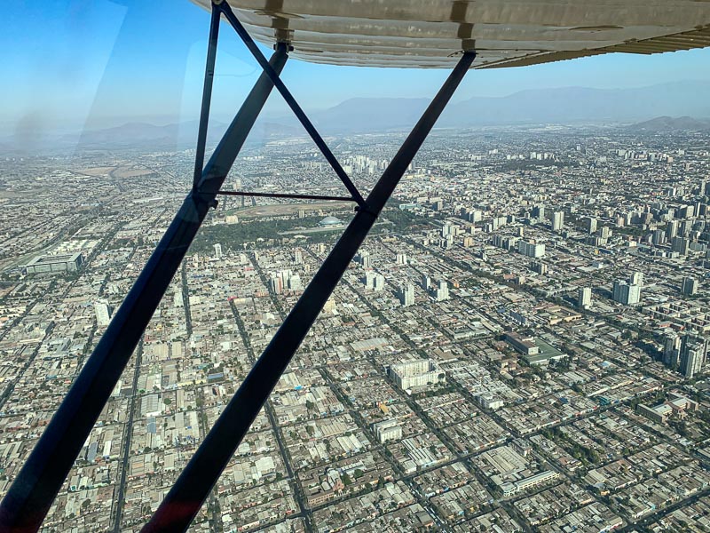
After San Felipe, I start to descent. Santiago International is close, so they want all VFR traffic flying low, close to the mountains, through the valleys. The turbulence down here is massive. In a downdraft, full power is not enough to keep the altitude. In an updraft, idle is required, to avoid the prop over speeding. Airspeed variates between yellow arc and stall speed. It is like riding a wild horse. Or better: Trying to control a leaf in the storm.
Karim had shown me the special visual routes into Vitacura in the AIP ENR section:
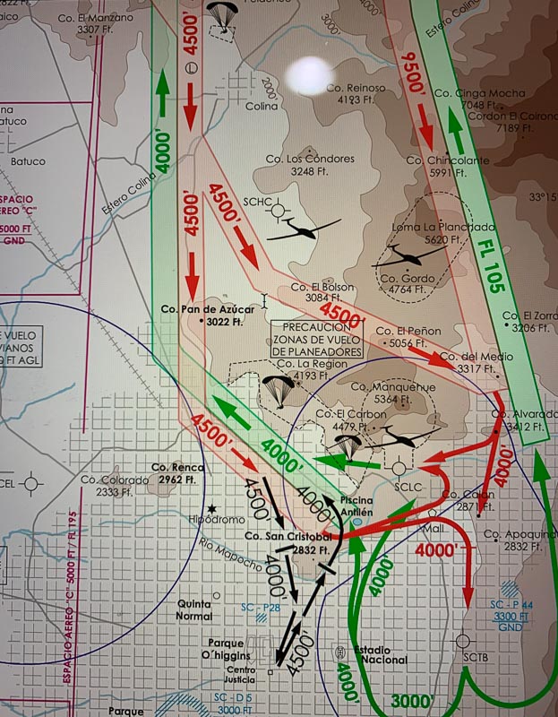
As these visual routes are neither depicted in Foreflight, nor in Air Navigation, I had to transfer them myself from the AIP into the flying apps:
Do you know the visual arrival route, the FIS lady asks me. She seems relieved, when I answer: Si, conozco route visual Via La Dehesa.
Over Cerro Alvaredo, I leave 4000 and see the little airfield in front of me:
It is TINY. The runway is only 550 m x 10 m. Remember Contadora in Panama? That runway was 700 m x 15 m and I found it short and narrow back then. Well, this was two years ago, and I have a lot more single engine experience now. I think 250 m x 7 m are sufficient. :-) Ups, Vitacura has a significant downslope. Did I miss this in my preparation?
Its parallel taxiway is so close to the runway, that the gliders with their mighty wingspans shouldn’t take off or land, when the taxiway is being used. There is some glider activity and with the exception of the towing aircraft, I am the only other guy who uses an engine.
I taxi to fueling. Surprise, surprise: Everybody here speaks English. Where are you flying from? They ask. United States. They stare in awe, but the answer to their next question: When did you start there? Leaves them speechless. Two years ago.
The friendly airfield manager allows me to park my 140 overnight next to another 140.
I book a hotel and walk an hour to reach it. Haven’t had much exercise lately.
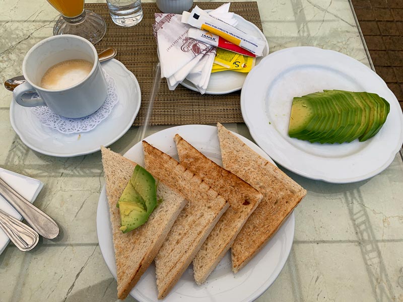
I wake up, pack my stuff, check out and walk back towards Vitacura airfield. On the way, I take a nice breakfast in a café, called Mozart. I don’t understand what the waitress says, but answer yes and get an avocado toast. Nice!
I see joggers, lots of joggers. On a first glance, there is not much difference between Santiago and a city in Europe or the USA.
N5581M is ready in a few minutes, I taxi towards the holding point of runway 25. I don’t find the holding point and end up between hangars - hey! This is something new. Never had difficulties before, to find the takeoff position. Ah ... here it is. Only 550 m and behind it hills and skyscrapers, now this is a take-off run. I held my breath that the engine doesn’t quit.
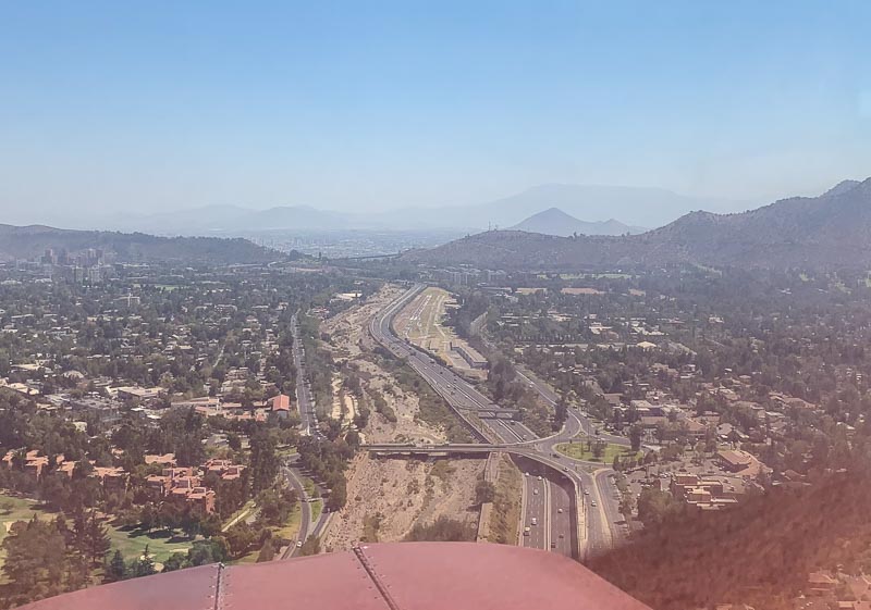
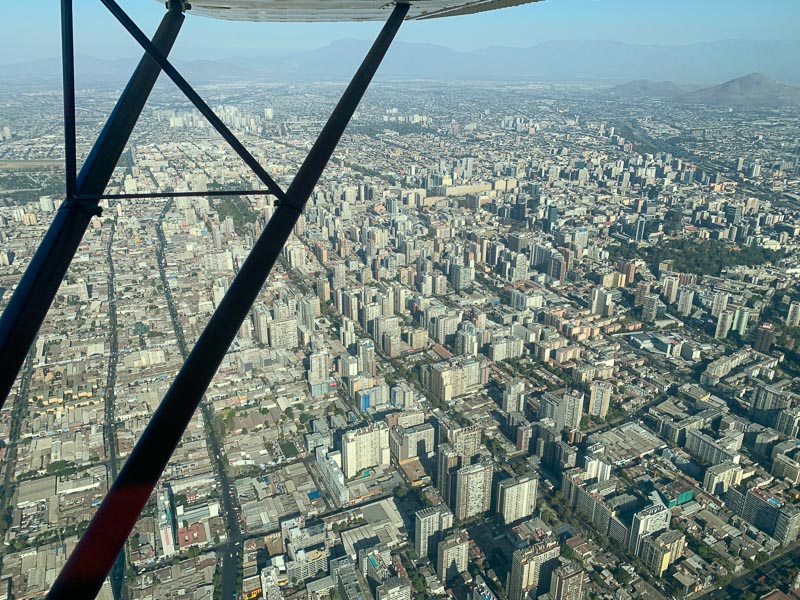
Take-off is followed by spectacular visual departure corridor HACIA EL SUR, right across downtown Santiago. It is as complex as the arrival corridor yesterday. Lots of turns, altitude restrictions and difficult talking in Spanish. Besides, breathtaking views of downtown Santiago. I like it.
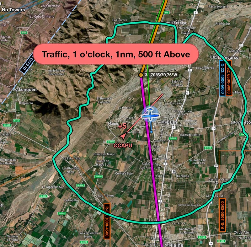
Foreflight warns me about ADS-B received traffic conflicts, but we are 500 feet apart. Strangely, I never see them:
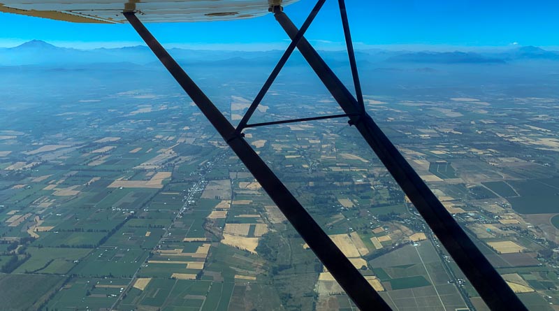
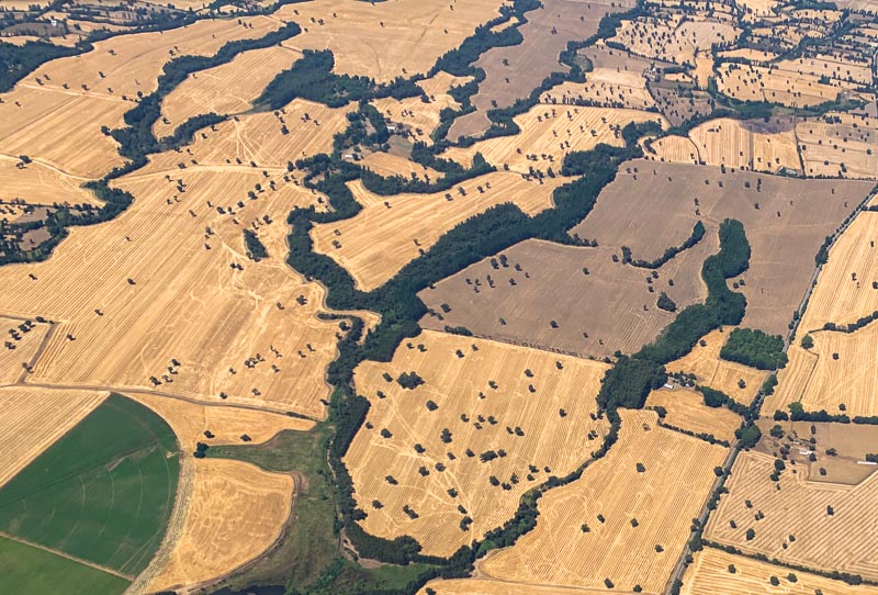
After a while, the city ends. I like this better. Higher survivability chance, if the engine quits. Less mountains too. They fade into the background. In the foreground, more and more green fields appear:
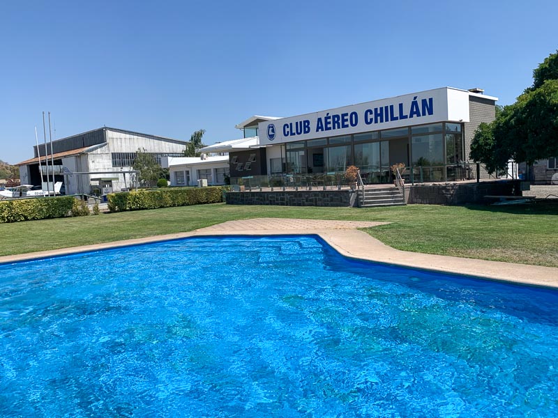
Chillan (SCCH) is my destination, uncontrolled airport, but with a large runway. Santiago Information told me to cancel my flight plan with Concepcion, but I can’t hear them. So, I fly towards them, because I don’t want to be the one who doesn’t close his flight plan properly. Cancel on ETA, as the Peruvians do, has its advantages. Now I get them and change to Chillan Info. The Aeroclub is at the southern end. Fueling is super-fast. We have a pattern here. Fueling at uncontrolled fields is much faster and more service oriented, then fueling at controlled airports. But there is no credit card self-fueling in Chile. Only the US seems to have this.
My plan is to stay here for two hours and there is a … pool, so I jump in and swim a few lanes:
Unfortunately, the pool is not deep enough for crawls. It is probably made for the kids, who are supposed to be entertained together with the esposas, while the maridos go flying. The Aeroclub in Ovalle had no female members. All pilots are man. Probably the same here at the Aeroclub of Chillan. Now, this is a difference to Europe and the USA, isn’t it?
Second flight today, I continue south:
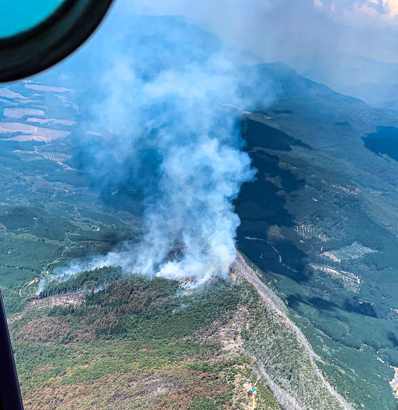
Originally, I wanted to fly to Temuco (SCTC), but Ignacio pointed out that there is a club activity in Curacautin (SCAI), so I make a little detour. There are more and more forsts now, but there is smoke from many of them. Wildfires, it seems:
I see ADS-B traffic targets, maybe helicopters involved in fire fighting? Many airports have a big open water tank to refill firefighting aircraft, I learn.
After 1,5 hours, I switch to Curacautin Unicom frequency. Dense VFR traffic around Curacautin, 4 Cessnas and a Bonanza were doing 15-minute flights with passengers. The club’s president Gonzalo manages the traffic with his portable radio. I land on the 800 m runway. Was supposed to be gras - but felt more like dirt. Park wherever you like, Gonzalo says.
I park next to what I think is a water tank, but later I learn that it is filled with Avgas. Gonzalo drags me to a long table, where the club members already eat. They welcome me like a hero, but I feel ashamed. I am no hero. The food is simple: Meat, potatoes, salad. Soft drinks for the pilots, beer and wine for everybody else.
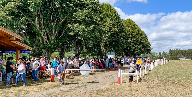
It is an interesting operation they do here: At the entrance to the airfield is a gate, behind it a long queue of people, maybe 200. They are waiting in line for hours to fly. Tickets are 20.000 pesos, about 24 US$, I learn:
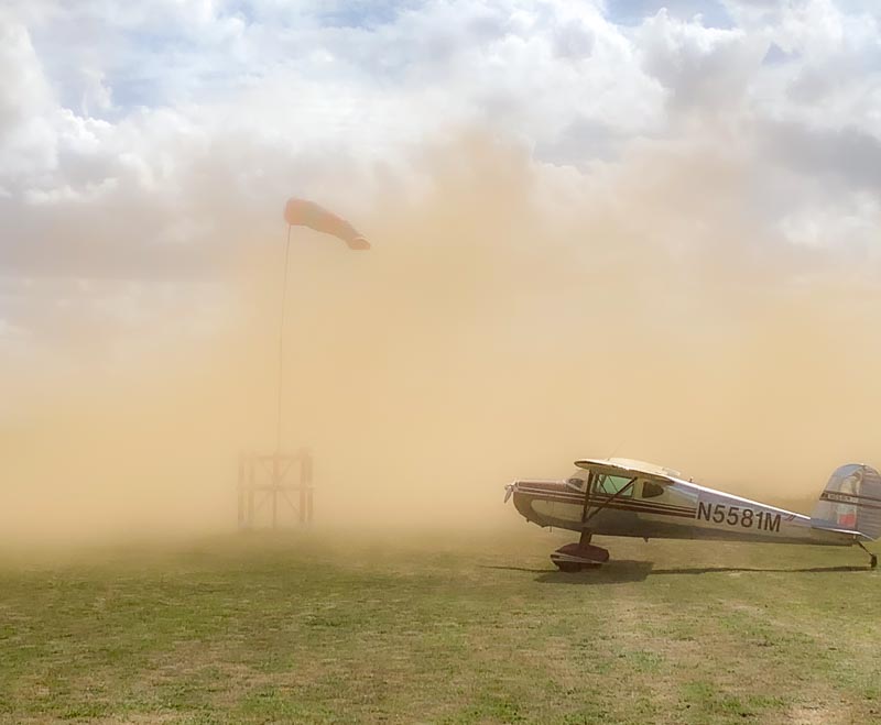
A club member with a yellow warning vest and the COVID mouth protection leads them in groups of three to the airplanes. Five planes, 15-minutes, this means every 3 minutes or so, we see a landing and a take-off. Each of them stirrs up the dirt. My plane and I inhale a lot of dirt this afternoon:
Three serious looking man watch the scene. They wear DGAC jackets and COVID mouth protection. Most others, including me, don’t. When a pilot lands too long or when he (again, no females!) doesn’t gain altitude at the end of the runway, they get interested. My plane catches their interest too. My first inspection, by Chile’s aviation authority, I think happily. I look around. There is a R44 helicopter. The owner explains that it has the same performance as a Cessna 172. He uses it to fly from his farm. Then I see two Pitts Special, acrobatic biplanes built since the 1940s. I talk to the pilots; they invite me to Villarrica (SCVI) and I agree to fly with them, after the show is over here in Curacautin.
A serious looking old man talks seriously to one of the young Pitts pilots. He explains him, where he is allowed to perform and were not. The pilot shows the crowd his skills in the Pitts: Rolls, loops, hammerheads, the full program. He flies south of the runway, while the flight ops with the guests continues:
We will leave at six o clock, I have been told, but it is actually seven, before they are ready. Fueling with hand pumps and gas cans takes time. Everybody gets gas before they leave. It is a kind of payment or a way to say thank you. Even I get offered some fuel. But I am a bit afraid of the dirt, so I don’t take any. They don’t use filters and I think of the tiny fuel filter within the carburetor, which I - until now - never cleaned.
We want to fly as a formation of four: A Cessna 172, the two Pitts and me. The briefing is short and I don’t understand any of it. Only the lead talks to Temuco Radar. We agree on an air-to-air frequency. We are faster, so we take off first, they say. Makes little sense to me, but so what.
The two Pitts take off simultaneously. They whirl up much dirt and mix it with their artificial show smoke, so that I must delay my take off because visibility temporarily dropes to zero. When I am airborne, they are all gone. Never trust strangers. I fly heading south for a while, call them on the radio, but we are not finding together. The weather is deteriorating. The clouds get lower, the hills higher, the sun is setting in the west.
After a while, I consider it unsafe to continue, so I turn west, avoid the bad weather in the south and proceed to my alternate, Temuco, Freire, La Araucania (SCQP). (I don’t know, why airports in Chile often have three names. Wouldn't be one name enough?) Would have loved to drink a beer together with the Pitts guys. But better safe, than sorry.
In Temuco, I park next to a group of helicopter. They seem to like copter here:
In the airport office, they tell me that Temuco is no real international airport, and anyhow, I didn’t send my internationalization request in time to all the necessary parties. So, I can’t fly to Argentina from here tomorrow. Maybe Tuesday. I am too tired to argue. An Uber drives me to a hotel.
My hotel takes COVID seriously. They check my passe de movilidad. It is quite full and due to the limited capacity of the breakfast room, they assign slots. Within the breakfast room, there is a one-way system. It is all a bit annoying, but the food is good.
I walk the Avenida Alemania to the German hospital. A sign reads Estadio German Becker. A bus is painted black, red, gold. Business names are German. A lot of Germans live here, I am told.
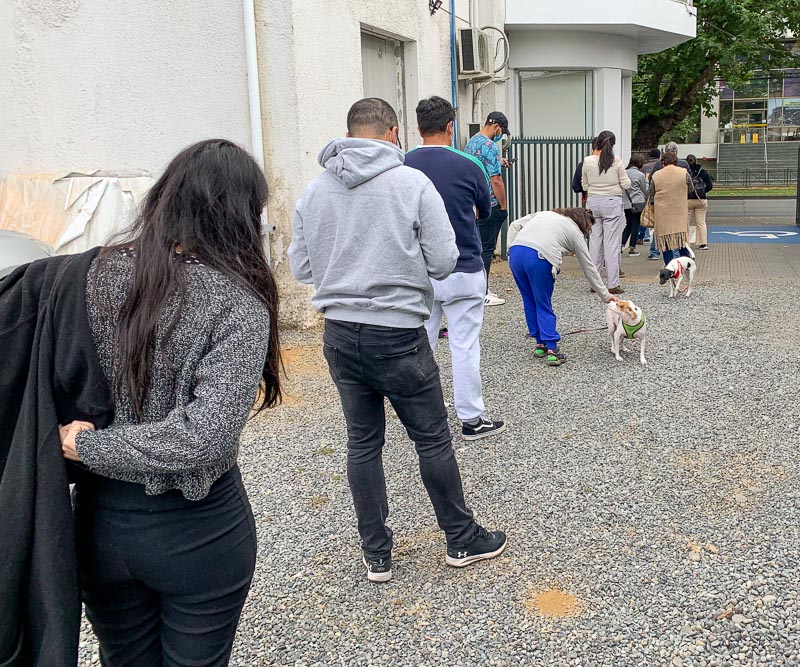
A long line of people waits to do the PCR test. I patiently join the line:
It takes an hour. Mouth or nose? I prefer the nose. Thanks for asking. The result should be there in 24 hours. Just in time for my departure to Argentina tomorrow.
I continue on Avenida Alemania to Starbucks. They usually have good internet. Not only the issue with the internalization request, there is another problem with my planned route:
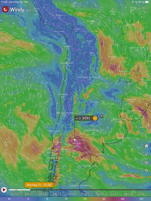
The Windy app shows, that - very unusual - I have to expect 30 knots of headwind over the Andes. It is a long from Temuco to Neuquen. Can't do it savely with 30 knots of headwind. Within two hours, I change all my requests and preparations: Instead of Temuco – Neuquen, I now want to cross the border 300 km further south: from Puerto Montt to Bariloche.
Forms need to be signed. Emails bounce back, because I did a typo or because the address has changed. Sometimes, I can only guess it. E. g. it seems that some Chilean authorities used addresses ending at .cl, but changed this in .gob.cl. In Argentina .gov.ar seems to be more popular. @gmail.com addresses are very popular among authorities too. It seems that @gmail.com is used as a backup, to assure reception, even when the local mail server fails.
I file a flight plan to Puerto Montt (SCTE) but get a reply from this airport reminding me that there is no space for overnight parking, so I change my destination of today to Paloma, Marcel Marchant, Puerto Montt’s downtown airport (SCPF), as recommended by Rodrigo.
An Uber brings me back to the Temuco airport. It is a blessing, that in many Chilean airports, pilots don’t have to go through the passenger terminal. They can go through a separate entrance, avoiding security.
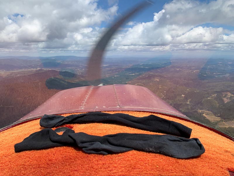
Take off for Paloma. Today only 3500 feet, there are clouds above. Green hills and forests below me, next to my drying socks: (Washing and drying clothes is a challenge, throughout this trip.)
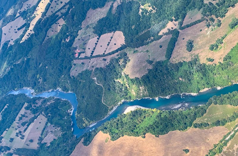
Take the lake route, I have been told. It is much nicer. But the clouds are just too low. It makes no sense flying further west, over the lakes and between the mountains. Too many clouds. But I can see the lakes in the distance. One after another. They feed rivers crossing my path, leading towards the Pacific, in the west.
The band of the Andes accompanied me since Colombia. Even yesterday, at Santiago, they formed a majestic barrier. But now, the wall is gone:
Just normal unimpressive mountains in the background. I know, I could cross them here in 5.500 ft. The high snow-capped volcanoes are isolated, no longer embedded between other high mountains.
Are you familiar with the area, asks the lady from Puerto Montt radar? We switch from Spanish to English and back. No, I am not familiar with the area, I reply. So what? Roger, is all she says. She doesn’t offer any special treatment and I don’t want any anyhow. I am a professional pilot, and my iPhone shows me the way.
The clouds get lower and lower, but I am nearly there, anyhow. Another 10 m wide runway. Rodrigo seems to love 10 m runways. He always recommends them to me. They operate line flights from this runway. Remarkable.
Again, an ultra-fast refueling and a helping hand to drag her over to parking, next to a little biz jet:
A few minutes after touchdown, I am already walking down to the harbor. I like Rodrigo's recommendations.
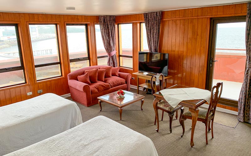
I am hungry. At a fruit stand, I chose fruits I can eat without tools: Grapes, apples, peaches. On my way, I book a hotel room. I am a booking.com expert, by now. The landscape looks a bit like Norway, but the city is shabbier than clean Norway. From the outside, my hotel looks shabby too. But the room has a spectacular view over Reloncavi Sound, I am happy to be here:
Tomorrow, I will cross the Andes. Looking forward to it.