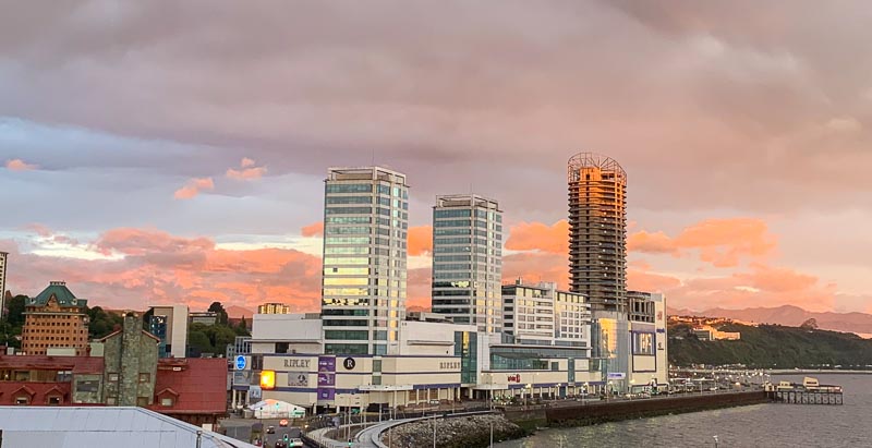
Fog had been forecasted for Puerto Montt, but Venus shines right into my eyes before sunrise. The sun creates a colourful morning over Reloncavi Sound:
I check out and walk the hour back to the airport. Walking alows me to think about this epic journey. I am now at the southern most point of the whole trip:
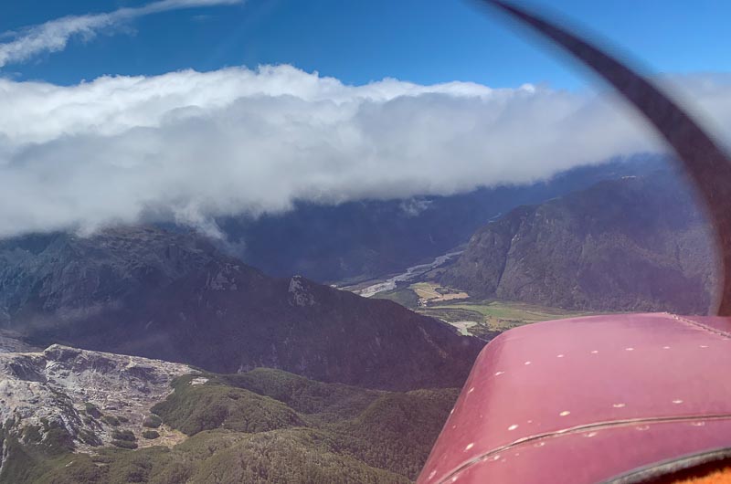
From 44,6 degrees northern latitude to 41,46 degrees southern latitude makes 86 degrees, nearly a quarter of the earth. If you consider the longitude difference and calculate the great circle distance between the most northern point I flew with N5581M, Oregon, and Puerto Montt, it is more than a quarter of the earth. 10706 km. And if you calculate the actual distance I flew, it is MUCH more. Maybe 15000 km? Time to check the weather. We still have a strong wind from the east - and a lot of clouds:

On the Argentinian side of the Andes, the windward side today, there will be even more clouds.
In the airport operation office, I ask if I must pay something for overnight parking, but it is free, as always in Chile. Friendly people at all the airfields in Chile. The ops lady shows me pictures of all the strange planes that landed here at Puerto Montt’s city airport Paloma (SCPF). It has a lot more traffic, than the much bigger Puerto Montt international airport (SCTE). We are the second busiest airport in Chile, she claims. The pictures include planes for scientific missions going to Antarctica, even to the German Georg-von-Neumeyer station there. There is no 100LL for the next 500 km south, she explains. I know that, whenever I explore southern Chile with my Cessna, I will go to Paloma again.
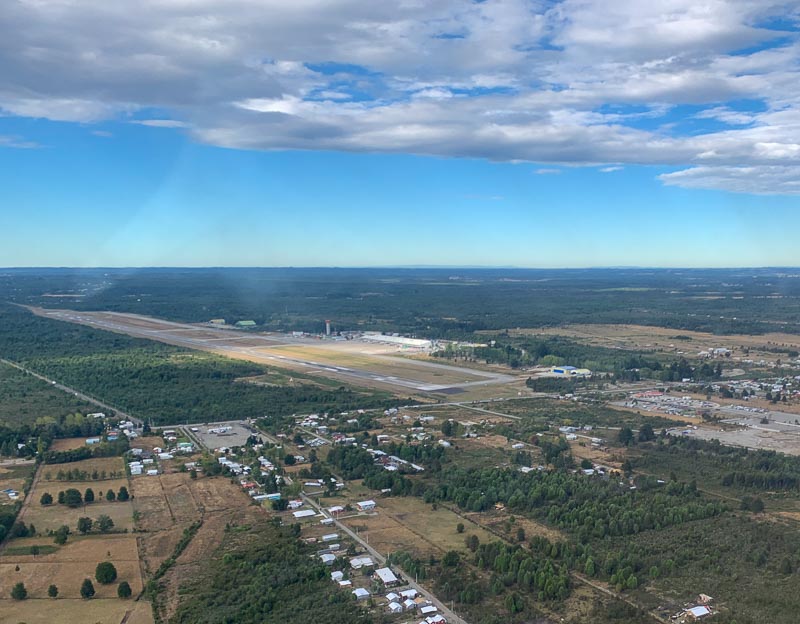
The flight time to Puerto Montt International is only a few minutes. As is the case in most Chilean airports, a lot of construction work is happening. Maybe government spending projects to fight a COVID recession? To a pilot it means, finding your way is difficult. My goal here is to do emigration and customs. But they are not here. Nobody read my emails. Yesterday was Sunday, I get told. I wait for two hours.
A friendly customs officer arrives. He wants to see a paper I should have received from customs in Iquique, but I don’t have it. He busily works in his computer, enters data, makes phone calls. What is the number of your engine? What is the serial number of your aircraft? Now you need the stamp from the border police, he says. But they are not here. I wait again. They arrive. They are young. Unsure, if they are allowed to stamp my passport. Phone call. Ok, I get the stamp. Back to customs. I get another stamp there. Can he help me get to my aircraft? No!
I need someone from airport security who is allowed to open the door for me. Everybody needs to hear my story, before he or she says that I need to ask someone else. Who am I? What are my intentions? It is all soooo time consuming. In my situation, it is hard not to hate international airports.
Last checks at the plane. I am excited. When I planned this journey, I considered the most challenging leg the one I want to do now: crossing the Andes. Down here, from Puerto Montt to Bariloche, it is only 1,5 hours, normally. The mountain pass is at 5.500 feet. A normal VFR crossing can be done in 7.500 ft.
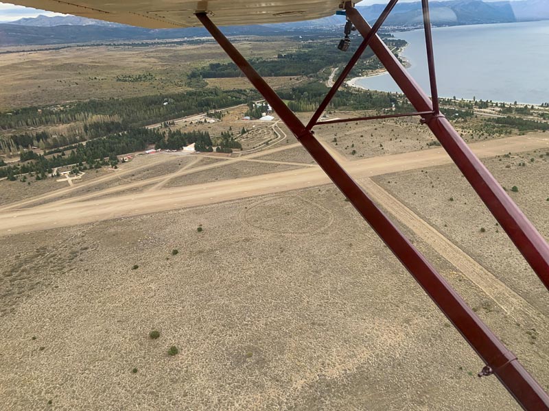
I take off and follow the southern coast of Llanquihue Lake.

South of the mighty snow covered Osorno volcano, clouds stop my climb at 5.500 ft.
I fly over Largo Todos los Santos, when clear air turbulences beat the little plane. Altitude goes up to 8000 and down to 5.500, within 2 minutes and despite counteracting with the power lever and airspeed. Bank angle never exceeds 45 degrees. I tighten the Hooker harness.
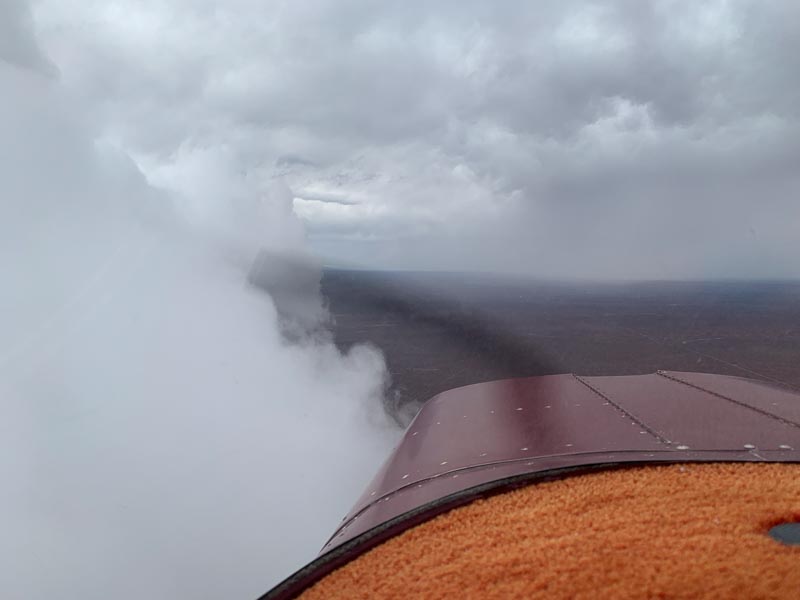
Above it, right in my altitude of 7.500 feet, are clouds. They demand an answer to the classical VFR question: Above or below?
Later I showed this picture to other pilots. Most of them would have chosen above. Some time ago, before Panama, I would have said the same. It seems instinctively safer, but it is not. Not always. Not, if you can barely climb over the cloud tops. Not, if you consider the engine failure case. Not, if you end up over Bariloche and don’t find the hole in the cloud cover to get down. Again, Rodrigo, with his 28 years of VFR experience, saw it coming: Maybe best option is low, he wrote me in the morning. But, like his maybe indicates, this is not a canned decision. It is a 1-minute analysis based on a proper pre-planning and a lot of experience. Each case is different.
I go down to 5000 feet, below the clouds and follow the valley and my pre-planned route, knowing that I am below the minimum height needed for the mountain pass. But the valley seems wide enough for a tight 180 degree turn, if necessary. I don’t feel cornered, I have a lot of options. I could even fly all the way home to Puerto Montt. Fuel and weather not being an issue for this option.
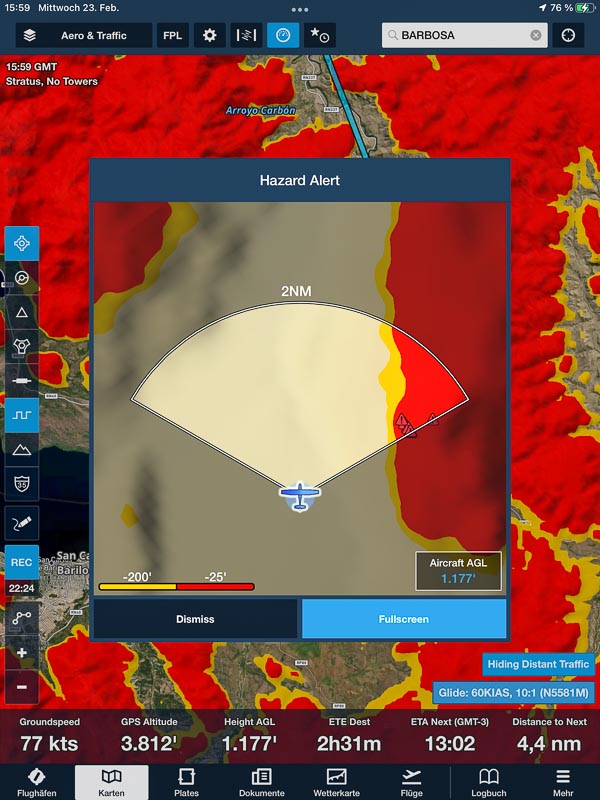
A lake appears behind the pass and below the clouds, proofing that the pass is free of clouds. iPad and iPhone now both show the Foreflight map, but with different settings. Foreflight’s Hazard alert is an important safety feature if you are unaware of the terrain hazard, but it is annoying, if you know that you are close to the ground, and it again and again pops up and avoids that you can see your route. You don’t want to end up in the wrong valley with the dead-end. So, it is active only on the iPad.
Turbulence again. Negative g, the iPhone on the dashboard falls between my feet. The straps don’t allow me to recover it right away. What a wind, here at the pass. Bank angle involuntarily exceeds 45 degrees. Over the pass, I dive down into the valley:
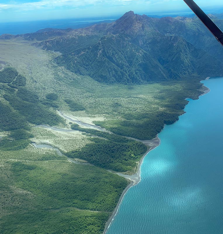
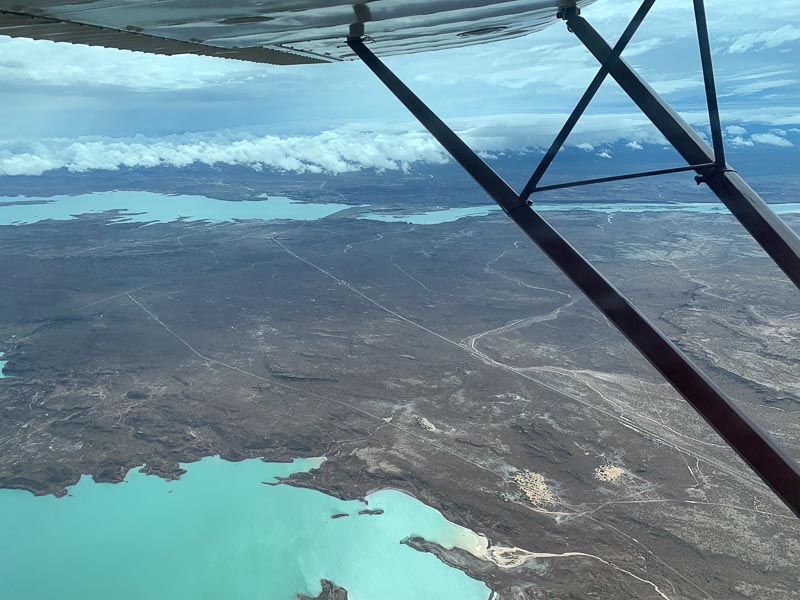
The lake below me is Brazo Blest, a part of the larger lago Patagua, belonging to Argentina. The clouds are lower here, maybe 4500 feet. Bariloche elevation is 2760 feet, the lake having maybe 2600 feet.
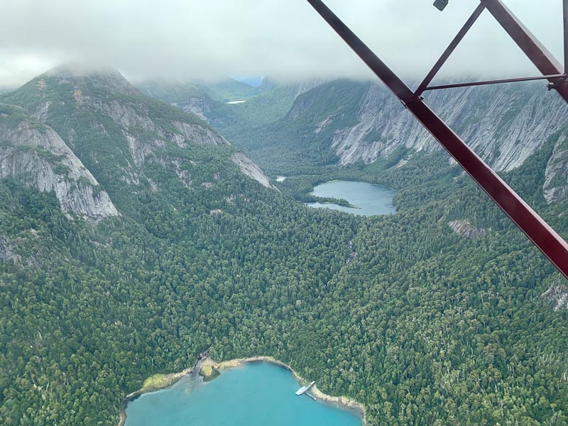
The area is beautiful. They do VFR sightseeing flights for tourists here, but maybe not today. I call Bariloche Tower and they tell me that they have overcast and ask me about my intentions, knowing that I cannot break through the clouds from above, when flying in accordance with the visual flight rules. I am below the clouds, I point out. He seems surprised.
Looking back and comparing this flight with other challenging VFR flights, e. g. the flight to Medellin, I don’t think it was dangerous. Of course, it depends on your viewpoint. Flights in general aviation, without the redundance of a second pilot and a second engine, are inherently dangerous. Flying close to the mountains and close to clouds in strong winds increase the risk. Mental pressures, induced by the bureaucracy of border crossings, decrease your willingness to turn around and increase risks further.
But there are also aspects reducing the risk: A good pre-planning including contingency options for failure cases, mental preparedness, no time pressure, lots of fuel (short route), light aircraft (no passenger, no full gas cans), healthy aircraft without known defects, an engine you can trust and an aircraft you know by heart, experience, advise from friends, redundancy navigation systems (two iOS devices), redundancy apps (Air Navigation and Foreflight), artificial horizon and knowing how to fly IFR - if you get in clouds - and a lot more.
I think, one hour of traffic pattern flying in a single engine aircraft over a city, e. g. in Mannheim, involves a greater risk than crossing the Andes from Puerto Montt to Bariloche in the weather I experienced. But I must confess that I don’t do traffic pattern in Mannheim. I consider it an unnecessary risk, which I try to avoid.
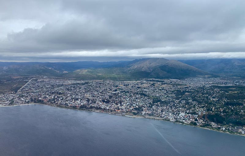
City of Bariloche comes into view. Used to be a lovely village, some say, but due to missing or ignored laws, everybody builds where and how he wants. So it is an ugly, sprawling city in a still beautiful landscape now.
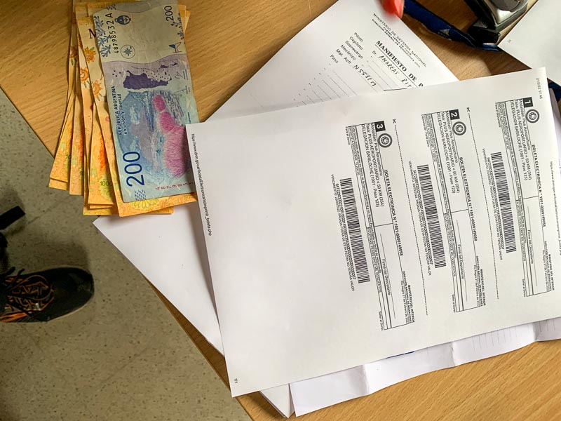
In Bariloche I refuel and taxi to Gate 6 of the passenger terminal. Welcome bureaucracy. It is still Monday and here, like in Chile, nobody read my Sunday emails. I wait for 2 hours. A lady from migraciones arrives. Like the one in Iquique, Chile, she wears no uniform. She is very friendly, treats me like a VIP. But it is time consuming. Forms. Questions. 100 US$ entrance fee, which I pay in Argentinian Pesos:
Welcome to Argentina! Customs arrives. Three grim looking men. Let’s go to the aircraft. Unpack everything, please. Some bags they check more intensely than others. E. g. the bag with my dirty underwear.
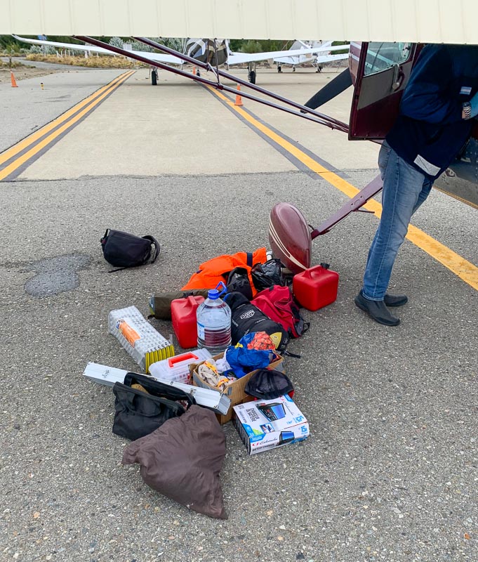
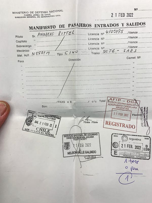
Or the folded aluminum foil, which he unfolds completely. (Part of my emergency equipment. To protect a cooking fire against wind and to keep the heat directed towards the water boiler. Back in 1993, Gerrit had shown me, how this reduces gas consumption and cooking time). The other two officers are only watching, not touching anything. They find nothing, ask nothing. I repack. Back in the terminal, the friendly lady stamps the last paper, but not my passport. Why not? I ask her. This is the first time entering Argentina without a passport stamp. You are crew, she points out. Crews don’t get their passports stamped.
It is already late. Like in Puerto Montt a NOTAM says that I cannot park overnight. There is a small airfield very close, Lago Nahuel Huapi. It is actually within the control zone of Bariloche International.
My third flight today, even shorter than the one from Paloma to Puerto Montt this morning. A rough dirt strip.
It would be better without the wheel pants and with the bigger tires I once flew, I think.
After touch down, Hermes and Federico welcome me. They have been alerted about my arrival by ... I forgot. By someone from the local aviation community, who follow my trip. I am flying solo, but never alone. Whereever I land, friends are already there.
Hermes is a retired Aerolinas Argentinas Captain who now flies a Tecnan 2006T, a beautiful efficient modern small twin. Federico is a flight instructor and president of the local flying club. He drives me to Bariloche city. But I need some more exercise, so I chose to walk the last hour to my hotel. Despite my reservation, it is fully booked. Now this is annoying; it is already 9 PM. Bariloche is nearly booked out. Holiday season. I take an overpriced room in a run-down private house with an unfriendly host.
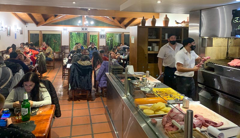
Weather is marginal, so I decide not to fly and stay in beautiful Bariloche. Besides, I have a lot of flight planning and administrative stuff to do. In the evening I enjoy a good dinner at Boliche de Alberto with friends.
Of course I change my accommodation. The new one is even more expensive, but much, much better.
Breakfast is supposed to be included, but I leave before the buffet opens. Before sunrise, a taxi brings me to to the dirt runway of Lago Nahuel Huapi airfield.
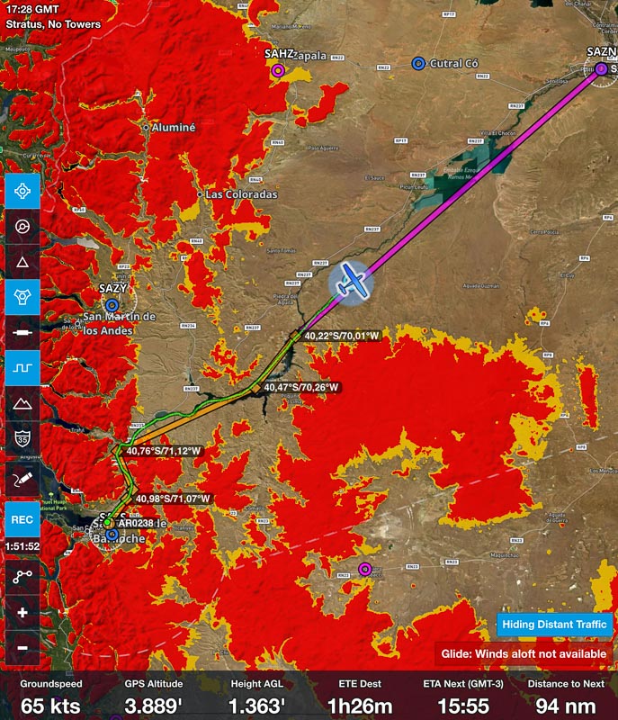
Still in darkness, I prepare the 140 for flight. The landing strip is so close to Bariloche International, that you contact Bariloche Tower with your radio prior to take-off. When I do this, they tell me that there is an issue with my flight plan. I filed a flight plan to Ingeniero Jacobacci (SAVJ), because a direct flight to Neuquen is not possible this morning, due to the strong headwinds. But the flight plan office tells me on the phone, that SAVJ is currently closed for the public. Must have overlooked that NOTAM. The caballero in the flight planning office and I consider other options. He is very helpful and my Spanish sufficient to work effectively together. But we find no good alternative. The airports north of Bariloche – San Martin de los Andes and Zapala – have low clouds and Cutral County further east is closed by NOTAM too. I decide to wait for a weaker headwind, allowing me to fly directly to Neuquen.
My taxi is gone, and I don’t know how to call a new one out here. Therefore, I walk from the airstrip to Dina Huapi village, about 90 minutes. Walking keeps me warm. We have 8 degrees this morning and all I have is unwashed T-Shirts and a thin raincoat. Tried several times to have my clothes washed but failed. The hotels I used had no washing service and I didn’t find any laundromat or overnight washing service outside. But I am happy that I have the raincoat, because it does start to rain now. Lousy weather. Dina Huapi is not fancy Bariloche. It is a simple, poor village spreading alongside the highway. Its shops are still closed. I feel miserably. The rain. The cold. I am hungry. Need a bathroom. No flying. No place to go. It is too early to check in in a new hotel again. And besides … they are all full.
A bakery is open. Dos media lunas por favor. Coffee from the machine is awful, I can’t drink it. At the end of the village, there is a small mall. I find free WIFI and a table and start to do some planning work. I am dry and warm and feeling much better. I file the new flight plan. Not via Foreflight like in Chile. This doesn’t work in Argentina, at least not for extranjeros. The guy in the office tells me, that the flight plan needs a legal signature. So, I calculate using foreflight, don’t file it, but create a PDF and add my scanned signature using the Mac OS preview app. Then, I email this PDF to acbar@eana.com.ar EANA is the Argentinian ATC company. BAR is the 3-Letter-Code for Bariloche and I guess AC stands for the flight plan office.
A few minutes later, I call the office. Is my flight plan okay? I ask. You cannot go in 4000, the minimum terrain clearance is 6000 feet. It is a visual flight, I point out. 6000 is the minimum height in the national park, he insists. My route is fully outside the national park, I declare. He has a new argument: There is an ATC strike today. Does this inhibit VFR traffic? I ask innocently. One moment please. He discusses my case with his colleague. Okay, you can go, he decides.
I take a taxi back to the air strip. The mountain tops are still in clouds. Not sure, if I can get out of here. Maybe I land after a traffic pattern.
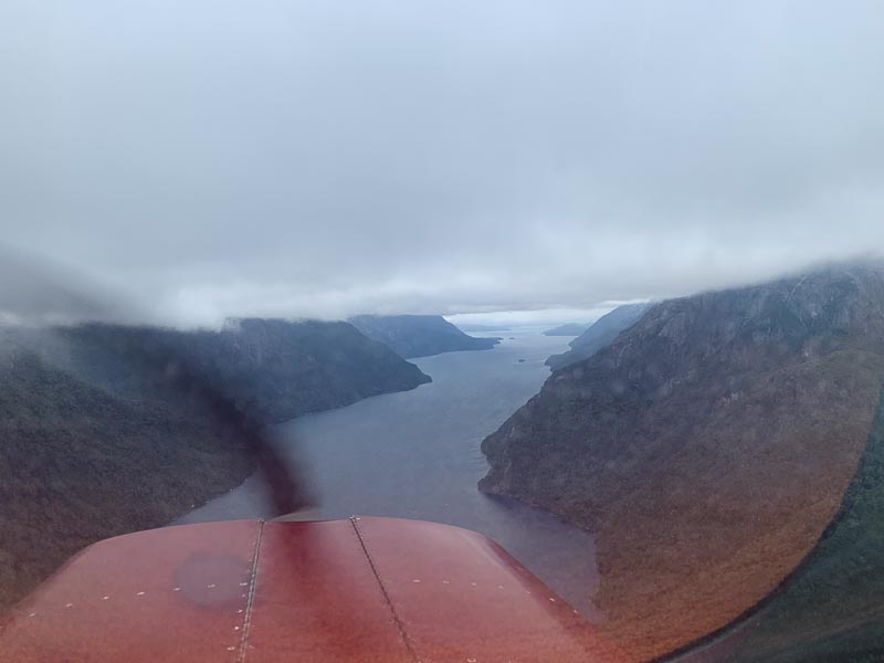
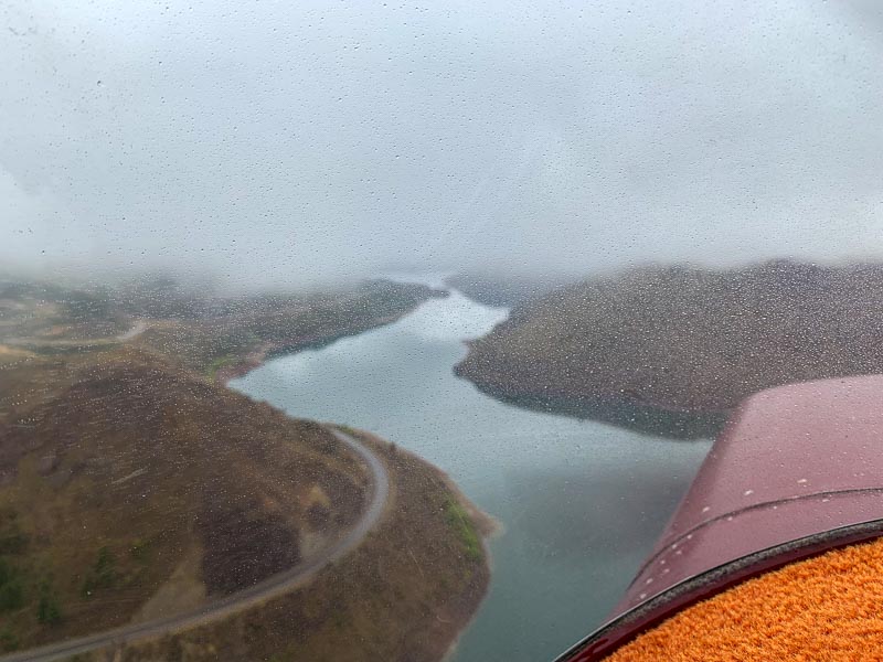
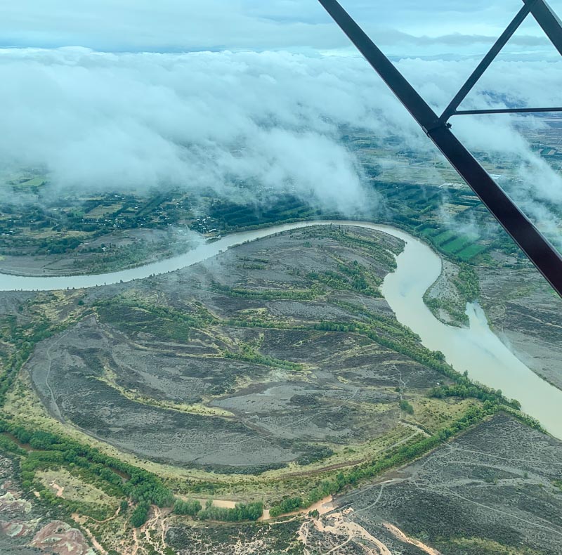
Call me when airborne, Bariloche Tower says. Take off downhill. Wind is calm. Right turn out, call the tower. Send a WhatsApp message, because there is no internet at the airstrip. A river flows out of Lago Nahuel Huapi:
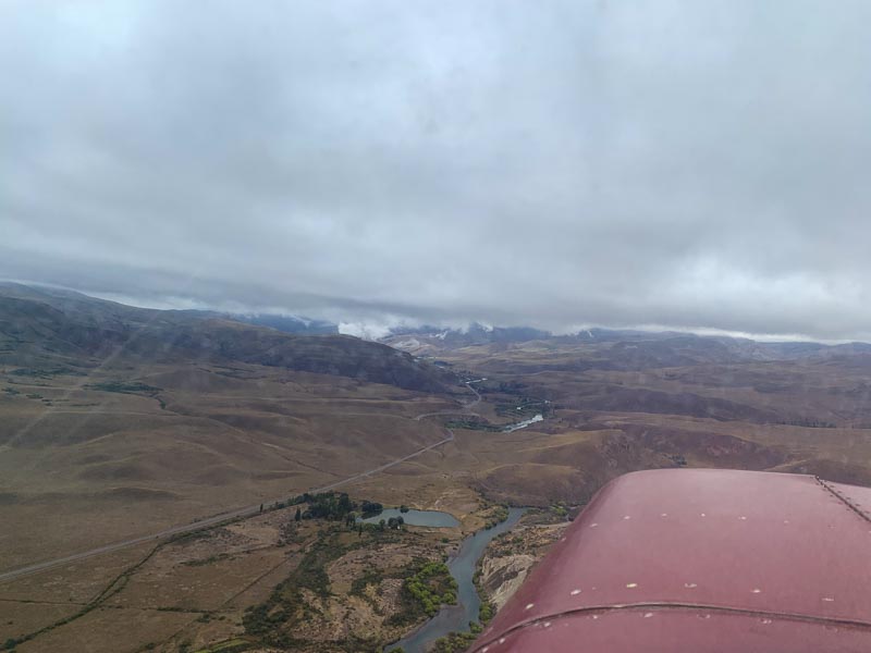
It is one of the sources of the Rio Nego, one of the biggest streams of Argentina. Following a river downstream is usually a good idea when the clouds are low. If you stay exactly over the river, at least you are not surprised by raising terrain. However, there may be man-made structures crossing the river. There is a nice cable car over the Rhein River at Koblenz. Following the Rhein in 500 feet would be a bad idea, though.
Unfortunately, my pre-planning was not as good as the one for my flight to Bariloche. I wasn’t 100% sure that there are no man-made structures over the river. The charts may not show them. Don’t trust aviation charts regarding man-made structures. Two or three times, the clouds press me down to 500 feet, but most of the time I fly about 1000 feet over the water. Hazard advisory appears a few times.
Still within the canyon. A bad day to fly. Again. Maybe even worse, than the flight to Bariloche. Or the canyon route to Medellin. In Bariloche, I thought I passed the Andes. But this is wrong. Bariloche lies within the Andes, not at its eastern slope as I thought.
After an hour, it is over. The mountains are behind me:
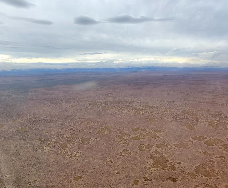
The clouds are still low, but it relaxes you a lot, if the Hazard Advisor shows no red left and right of your track anymore. Empty land below me. Not a desert, there is some vegetation. Maybe bushes? But no people. The road to Bariloche in the distance. And the river. I still follow the Rio Negro, but no longer accurately. While it meanders, I fly a straight line now. Direct to Neuquen. At least most of the time. Because suddenly, there is a cumulus cloud in my way. A course change keeps me out of the cloud, but still too close:
The variometer climbs and the airspeed increases. From 3700 to 6300 in 4 minutes, the fastest climb I ever had with the 140 and this with idle power. I stay above the lowest cloud layer here. Neuquen is not far anymore.
The headwind is weaker than feared. In the end, flight time is 2:58, using 55 l.
My host, Juan, explains the security procedure to me. There is a web form at yovuelo.com.ar you need to fill out and send to the police prior to each departure and arrival at a controlled airport in Argentina. Very easy, Juan says. An hour after I landed, heavy rain starts. Without the community's help, my 140 wouldn't have been save in a hangar during the storm.